Project
Community
News
My maps
Mappa catalogata
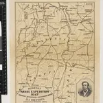
Western Battle-Ground. Western Naval Expedition Map
Titolo completo:
Western Battle-Ground. Western Naval Expedition Map
Editore:
L. Prang & Co.
Dimensione fisica:
20 x 30 cm
La storia