Maps of Thüringen

Il circolo di Franconia diviso ne suoi stati
1 Karte : Kupferdruck ; 40 x 30 cm Zatta; Zuliani; Pitteri presso Antonio Zatta
Franconia vulgo Franckenlandt
1 Karte : Kupferdruck ; 26 x 34 cm Merian M. Merian ex
Circulus Franconicus
1 Karte : Kupferdruck ; 49 x 57 cm Danckerts Theodorus Danckerts
Circulus Franconicus
1 : 640000 1 Karte : Kupferdruck ; 49 x 57 cm Danckerts, Theodorus [Danckerts]
Nova Atque Exacta Franconiae Tabula in Ditiones Praeturas et Praefecturas.
1 : 640000 Mollova mapová sbírka Schenk, Pieter Schenk, Peter II
Der Fraenkische Kreis

Circulus Franconicus
1 : 630000 Mollova mapová sbírka Danckerts, Theodorus Danckerts, Theodor
Strassen- und Eisenbahnkarte des oesterreichischen Kaiserthumes
1 : 864000 Blatt 1 Schaller, G. K.K. Militärisch-Geografisches Institut, Karten-Evidenthaltungs-Abteilung
Le cercle de Franconie
1 Karte : Kupferdruck ; 44 x 59 cm Jaillot; Ottens; Ottens chez R. et J. Ottens
Le cercle de Franconie
1 Karte : Kupferdruck ; 44 x 59 cm Jaillot Alexis-Hubert Jaillot
Franconiæ nova descriptio
1 Karte : Kupferdruck ; 40 x 52 cm Janssonius; Rittershausen Johannes Janssonius excud
Charte von Franken
1 Karte : Kupferdruck ; 43 x 51 cm Kreibich im Verlage des Geographischen Instituts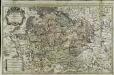
Le cercle de Franconie
1 Karte auf 2 Blatt : Kupferdruck ; 52 x 84 cm Jaillot; Sanson chez H. Iaillot joignant les grands Augustins aux deux globes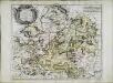
Cercle de Franconie
1 Karte : Kupferdruck ; 40 x 49 cm Sanson; Mariette chez Pierre Mariette rue St. Iacques a l'Esperance
Fränkischer Kreis
Allgemeiner Atlas [Walch, Johannes] im Verlag bei Johannes Walch
Franconia.
1 : 600000 Lizars, Daniel
Cercle de Franconie
1 Karte : Kupferdruck ; 47 x 55 cm Robert de Vaugondy; Haussard G. et D. Robert de Vaugondy
[50][50] Circulus Franconicus, ..., uit: Atlas sive Descriptio terrarum orbis
Annotatie: Gedigitaliseerde versie. Amsterdam. Heiloo : Picturae (vervaardiger), 2015. tiff-bestand. Gedigitaliseerd: 07-01-2015; Origineel: Universiteitsbibliotheek Vrije Universiteit (XL.05127.-) ; Netherlands; Titelpagina ontbreekt Wit, Frederik de Amsterdam : Frederick de Wit
Charte von dem Fränkischen Kreise
1 Karte : Kupferdruck ; 43 x 51 cm Kreibich im Verlage des Landes-Industrie-Comptoirs
Le cercle de Franconie
1 Karte auf 2 Blatt : Kupferdruck ; 53 x 85 cm Jaillot; Sanson; Chauveau chez H. Iaillot joignant les grands Augustins aux deux globes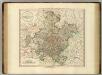
Franconia.
1 : 585000 Cary, John, ca. 1754-1835
Das Herzogthum Ostfranken in seine Gauen eingetheilt
1 : 771000 Franky (Německo) Spruner, Karl von Rössert, Josef
Das Herzogthum Ostfranken in seine Gauen eingetheilt
1 : 771000 Franky (Německo) Spruner, Karl von Rössert, Joseph
Der Fraenkische Kreis nebst den angraenzenden Laendern
1 : 350000 Franky (Německo) Hammer, C. F. Lochner, Carl Frid. im Verlag der kaiserlich privilegirten Hommanischen Handlung
Le Cercle de Franconie
1 : 600000 Mollova mapová sbírka Jaillot, Alexis-Hubert Ottens, Josua
Le Cercle de Franconie
1 : 600000 Mollova mapová sbírka Jaillot, Alexis-Hubert Jaillot, Alexis Hubert
Le Cercle De Franconie subdivisé entous les Estats qui le composent [Karte], in: Atlas nouveau, contenant toutes les parties du monde [...], Bd. 1, S. 275.
1 Karte aus Atlas Sanson, Nicolas Jaillot, Alexis Hubert und Mortier, Pieter
Charte von dem nordwestlichen Theile des Königreichs Bayern, dem Grossherzogthume Würzburg, dem Fürstenthume Aschaffenburg [et]c.c., oder der Maÿn
1 Karte : Kupferdruck ; 43 x 51 cm Kreibich im Verlage des Geographischen Instituts
Franconiae Nova Descriptio. [Karte], in: Novus atlas absolutissimus, Bd. 2, S. 174.
1 Karte aus Atlas Janssonius Offizin


