Maps of Kralupy nad Vltavou


Plan der Gegend zwischen Kletzan und Weltrus
1 : 47500 Klecany (Česko) Schwihlik, F.
Plan der Gegend zwischen Kletzan und Weltrus
1 : 48000 Klecany (Česko) Adam
Gradkartenblatt
1 : 25000 Čechy (Česko) Czechák, Carl
III. vojenské mapování 3953/1
1 : 25000
III. vojenské mapování 3953/1
1 : 25000
Mapa politického a školního okresu Karlínského

Karte des Welwarner Bezirkes im Prager Kreise
1 : 72400 Velvary-oblast (Česko) Wagner, Jan Eduard Karl André
Karte des Welwarner Bezirkes im Prager Kreise
1 : 72400 Velvary-oblast (Česko) Wagner, Jan Eduard Karl André
III. vojenské mapování 3952/2
1 : 25000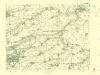
III. vojenské mapování 3952/2
1 : 25000
Bez titulu: Umgebungen von Prag

Plan der Gegend von Tursko
1 : 26400 Praha-oblast (Česko)
Plan der Gegend von Tursko
Kralupy nad Vltavou-oblast (Česko) Kašpar, Karel Slavoj Khün
PLAN DES Tuchomeirzitzer, Cizoniczer, Strzedokluker und Russiner Revieres
1 : 3000 Tuchoměřice (Česko)
Výškopisný plán hlavního města Prahy s okolím

Výškopisný plán hlavního města Prahy s okolím

Situations Karte der Excellenz gräflich Nostitz'schen Domaine Pakoměřitz in Böhmen
1 : 20000 Neratovice-oblast (Česko) K.k. Hofbuchdruckerei von Gottlieb Haase Söhne
Orientační plán hlavního města Prahy

Orientierungsplan der Hauptstadt Prag
Jiřík, Rudolf
Gross Bascht (Welky Basst) - c0076-1-004 - Kaiserpflichtexemplar der Landkarten des stabilen Katasters
1 : 2880
Gross Bascht (Welky Basst) - c0076-1-001 - Kaiserpflichtexemplar der Landkarten des stabilen Katasters
1 : 2880
Gross Bascht (Welky Basst) - c0076-1-003 - Kaiserpflichtexemplar der Landkarten des stabilen Katasters
1 : 2880
Gross Bascht (Welky Basst) - c0076-1-002 - Kaiserpflichtexemplar der Landkarten des stabilen Katasters
1 : 2880
Gross Bascht (Welky Basst) - c0076-1-005 - Kaiserpflichtexemplar der Landkarten des stabilen Katasters
1 : 2880
Tuchoměřzitz (Tuchoměřzice) - c8098-1-001 - Kaiserpflichtexemplar der Landkarten des stabilen Katasters
1 : 2880
Tuchoměřzitz (Tuchoměřzice) - c8098-1-002 - Kaiserpflichtexemplar der Landkarten des stabilen Katasters
1 : 2880
Tuchoměřzitz (Tuchoměřzice) - c8098-1-005 - Kaiserpflichtexemplar der Landkarten des stabilen Katasters
1 : 2880
Tuchoměřzitz (Tuchoměřzice) - c8098-1-004 - Kaiserpflichtexemplar der Landkarten des stabilen Katasters
1 : 2880


