Maps of Luže

Katastrální mapa pro obec Srbce
1 : 2880
Katastrální mapa pro obec Voletice a osadu Domanice
1 : 2880
Indikační skica mapy stabilního katastru pro obec Srbce
1 : 2880
Srbetz - c7191-1-001 - Kaiserpflichtexemplar der Landkarten des stabilen Katasters
1 : 2880
Srbetz - c7191-1-002 - Kaiserpflichtexemplar der Landkarten des stabilen Katasters
1 : 2880
Indikační skica mapy stabilního katastru pro obec Voletice a osadu Domanice
1 : 2880
Wolletitz (Wolletic) - c8760-1-003 - Kaiserpflichtexemplar der Landkarten des stabilen Katasters
1 : 2880
Wolletitz (Wolletic) - c8760-1-001 - Kaiserpflichtexemplar der Landkarten des stabilen Katasters
1 : 2880
Wolletitz (Wolletic) - c8760-1-002 - Kaiserpflichtexemplar der Landkarten des stabilen Katasters
1 : 2880
Mapa cest a silnic polesí Košumberk
1 : 10000
Mapa polesí Košumberk
1 : 10000
Lusche (Luže) - c4326-1-001 - Kaiserpflichtexemplar der Landkarten des stabilen Katasters
1 : 2880
Lusche (Luže) - c4326-1-002 - Kaiserpflichtexemplar der Landkarten des stabilen Katasters
1 : 2880
Lusche (Luže) - c4326-1-003 - Kaiserpflichtexemplar der Landkarten des stabilen Katasters
1 : 2880
Rzepnik (Řepnik) - c6698-1-001 - Kaiserpflichtexemplar der Landkarten des stabilen Katasters
1 : 2880
Rzepnik (Řepnik) - c6698-1-004 - Kaiserpflichtexemplar der Landkarten des stabilen Katasters
1 : 2880
Rzepnik (Řepnik) - c6698-1-003 - Kaiserpflichtexemplar der Landkarten des stabilen Katasters
1 : 2880
Rzepnik (Řepnik) - c6698-1-002 - Kaiserpflichtexemplar der Landkarten des stabilen Katasters
1 : 2880
Katastrální mapa pro obec Voletice a osadu Domanice
1 : 2880
Katastrální mapa pro obec Srbce
1 : 2880
Pieschitz - c5755-1-001 - Kaiserpflichtexemplar der Landkarten des stabilen Katasters
1 : 2880
Pieschitz - c5755-1-002 - Kaiserpflichtexemplar der Landkarten des stabilen Katasters
1 : 2880
Katastrální mapa pro obec Pěšice
1 : 2880
Indikační skica mapy stabilního katastru pro obec Srbce
1 : 2880
Mapa polesí Luže
1 : 10000
Gradkartenblatt
1 : 25000 Chrast (Chrudim, Česko) Hallada, Alois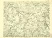
III. vojenské mapování 4056/1
1 : 25000
III. vojenské mapování 4056/1
1 : 25000


