Maps of Stéblová

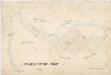
Indikační skica mapy stabilního katastru pro obec Stéblová V.
1 : 2880
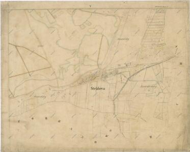
Hospodářská mapa revíru Stéblová
1 : 5000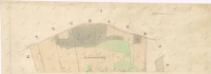
Indikační skica mapy stabilního katastru pro obec Pohránov I.
1 : 2880
Mapa pozemků bývalého rybníka Velká Čeperka V.
1 : 2880
Mapa lesa Obora u Stéblové
1 : 2880
Mapa polesí Stéblová
1 : 5000
Obora Týniště a Oplatil u Stéblové
1 : 2880
Steblowa - c7325-1-004 - Kaiserpflichtexemplar der Landkarten des stabilen Katasters
1 : 2880
Steblowa - c7325-1-001 - Kaiserpflichtexemplar der Landkarten des stabilen Katasters
1 : 2880
Steblowa - c7325-1-002 - Kaiserpflichtexemplar der Landkarten des stabilen Katasters
1 : 2880
Steblowa - c7325-1-003 - Kaiserpflichtexemplar der Landkarten des stabilen Katasters
1 : 2880
Hospodářská mapa revíru Stéblová
1 : 2880
Síťová mapa pozemků na území bývalého rybníka Oplatil
1 : 2880
Přehledová mapa pozemků bývalého rybníka Oplatil
1 : 4320
Mapa revíru Hrádek
1 : 2600
Mapa pozemků bývalého rybníka Oplatil
1 : 5760
Mapa pozemků bývalého rybníka Oplatil
1 : 2880
Hospodářská mapa revíru Stéblová
1 : 2880
Srch - c7204-1-003 - Kaiserpflichtexemplar der Landkarten des stabilen Katasters
1 : 2880
Srch - c7204-1-002 - Kaiserpflichtexemplar der Landkarten des stabilen Katasters
1 : 2880
Srch - c7204-1-001 - Kaiserpflichtexemplar der Landkarten des stabilen Katasters
1 : 2880
Indikační skica mapy stabilního katastru pro obec Pohránov I.-II.
1 : 2880
Pachtovní mapa pozemků Oplatil
1 : 2880
Indikační skica mapy stabilního katastru pro obec Srch II.
1 : 2880
Porostní mapa revíru Stéblová
1 : 3150
Pohranow - c5958-1-002 - Kaiserpflichtexemplar der Landkarten des stabilen Katasters
1 : 2880
Pohranow - c5958-1-001 - Kaiserpflichtexemplar der Landkarten des stabilen Katasters
1 : 2880
Mapa probírek revíru Stéblová
1 : 5000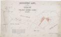
Hospodářská mapa revíru Stéblová
1 : 2880