Maps of Moravany

Indikační skica mapy stabilního katastru pro obec Horní Roveň VII.
1 : 2880
Indikační skica mapy stabilního katastru pro obec Čeradice I.-II.
1 : 2880
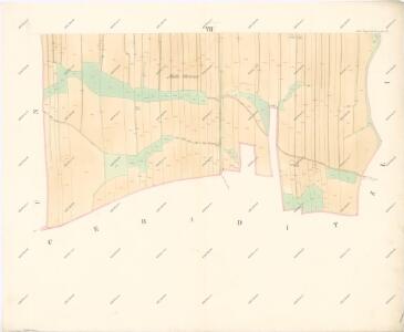
Katastrální mapa pro obec Uhersko
1 : 2880
Ceraditz - c0856-1-002 - Kaiserpflichtexemplar der Landkarten des stabilen Katasters
1 : 2880
Ceraditz - c0856-1-001 - Kaiserpflichtexemplar der Landkarten des stabilen Katasters
1 : 2880
Indikační skica mapy stabilního katastru pro obec Horní Roveň I.-VII.
1 : 2880
Ober Rowen (Hornj Rowen) - c2138-1-003 - Kaiserpflichtexemplar der Landkarten des stabilen Katasters
1 : 2880
Ober Rowen (Hornj Rowen) - c2138-1-001 - Kaiserpflichtexemplar der Landkarten des stabilen Katasters
1 : 2880
Ober Rowen (Hornj Rowen) - c2138-1-004 - Kaiserpflichtexemplar der Landkarten des stabilen Katasters
1 : 2880
Ober Rowen (Hornj Rowen) - c2138-1-002 - Kaiserpflichtexemplar der Landkarten des stabilen Katasters
1 : 2880
Ober Rowen (Hornj Rowen) - c2138-1-005 - Kaiserpflichtexemplar der Landkarten des stabilen Katasters
1 : 2880
Indikační skica mapy stabilního katastru pro obec Dolní Roveň I.-VI.
1 : 2880
Indikační skica mapy stabilního katastru pro obec Čeradice I.
1 : 2880
Unter Rowen (Dolnj Rowen) - c1379-1-001 - Kaiserpflichtexemplar der Landkarten des stabilen Katasters
1 : 2880
Unter Rowen (Dolnj Rowen) - c1379-1-002 - Kaiserpflichtexemplar der Landkarten des stabilen Katasters
1 : 2880
Unter Rowen (Dolnj Rowen) - c1379-1-004 - Kaiserpflichtexemplar der Landkarten des stabilen Katasters
1 : 2880
Unter Rowen (Dolnj Rowen) - c1379-1-005 - Kaiserpflichtexemplar der Landkarten des stabilen Katasters
1 : 2880
Unter Rowen (Dolnj Rowen) - c1379-1-003 - Kaiserpflichtexemplar der Landkarten des stabilen Katasters
1 : 2880
Indikační skica mapy stabilního katastru pro obec Dolní Roveň VI.
1 : 2880
Indikační skica mapy stabilního katastru pro obec Litětiny IV., V.
1 : 2880
Indikační skica mapy stabilního katastru pro obec Horní Roveň V.
1 : 2880
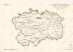
Mapa politického okresu Pardubického

III. vojenské mapování 3956/3
1 : 25000
III. vojenské mapování 3956/3
1 : 25000


Eisenbahn Karte Wien-Dresden, Ollmütz-Trübau
1 : 72000 Blatt 10 Minarzik, Anselm J. Rauh
Domäne Daschitz
1 : 57600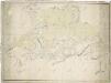
Mapa tzv. Horních revírů (albrechtický, bělečský, holický, hrádecký, chvojenecký a vysocký)
1 : 13500