Maps of Rokytno

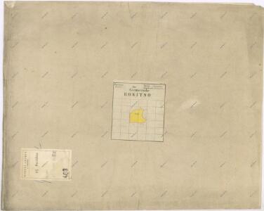
Indikační skica mapy stabilního katastru pro obec Rokytno I.-VI.
1 : 2880
Rokitno - c6528-1-001 - Kaiserpflichtexemplar der Landkarten des stabilen Katasters
1 : 2880
Rokitno - c6528-1-003 - Kaiserpflichtexemplar der Landkarten des stabilen Katasters
1 : 2880
Rokitno - c6528-1-002 - Kaiserpflichtexemplar der Landkarten des stabilen Katasters
1 : 2880
Rokitno - c6528-1-004 - Kaiserpflichtexemplar der Landkarten des stabilen Katasters
1 : 2880
Indikační skica mapy stabilního katastru pro obec Rokytno III.
1 : 2880
Indikační skica mapy stabilního katastru pro obec Chvojenec a osadu Drahoš III.
1 : 2880
Indikační skica mapy stabilního katastru pro obec Rokytno IV.
1 : 2880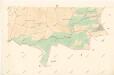
Indikační skica mapy stabilního katastru pro obec Rokytno VI.
1 : 2880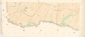
Indikační skica mapy stabilního katastru pro obec Rokytno V.
1 : 2880
Indikační skica mapy stabilního katastru pro obec Dolní Ředice a osadu Drahoš II.
1 : 2880
Indikační skica mapy stabilního katastru pro obec Újezd u Sezemic II.
1 : 2880
Indikační skica mapy stabilního katastru pro obec Býšť V.
1 : 2880
Indikační skica mapy stabilního katastru pro obec Hrachoviště III.
1 : 2880
Indikační skica mapy stabilního katastru pro obec Rokytno II.
1 : 2880
Indikační skica mapy stabilního katastru pro obec Bohumileč ad II.
1 : 2880
Indikační skica mapy stabilního katastru pro obec Choteč II.
1 : 2880
Augezd - c8208-1-003 - Kaiserpflichtexemplar der Landkarten des stabilen Katasters
1 : 2880
Augezd - c8208-1-001 - Kaiserpflichtexemplar der Landkarten des stabilen Katasters
1 : 2880
Augezd - c8208-1-002 - Kaiserpflichtexemplar der Landkarten des stabilen Katasters
1 : 2880
Indikační skica mapy stabilního katastru pro obec Choteč I.-IV.
1 : 2880
Chotsch - c2574-1-001 - Kaiserpflichtexemplar der Landkarten des stabilen Katasters
1 : 2880
Chotsch - c2574-1-003 - Kaiserpflichtexemplar der Landkarten des stabilen Katasters
1 : 2880
Chotsch - c2574-1-002 - Kaiserpflichtexemplar der Landkarten des stabilen Katasters
1 : 2880
Indikační skica mapy stabilního katastru pro obec Bohumileč III.
1 : 2880
Bohumiletsch - c0316-1-001 - Kaiserpflichtexemplar der Landkarten des stabilen Katasters
1 : 2880
Bohumiletsch - c0316-1-002 - Kaiserpflichtexemplar der Landkarten des stabilen Katasters
1 : 2880
Bohumiletsch - c0316-1-003 - Kaiserpflichtexemplar der Landkarten des stabilen Katasters
1 : 2880
Gradkartenblatt
1 : 25000 Holice-oblast (Pardubice, Česko) Böhm, Karl