Maps of Dolní Ředice

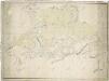
Indikační skica mapy stabilního katastru pro obec Dolní Ředice a osadu Drahoš II.
1 : 2880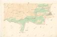
Indikační skica mapy stabilního katastru pro obec Rokytno VI.
1 : 2880
Indikační skica mapy stabilního katastru pro obec Choteč II.
1 : 2880
Indikační skica mapy stabilního katastru pro obec Dolní Ředice a osadu Drahoš I.-VII.
1 : 2880
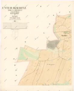
Unter Rzeditz (Dolnj Rzedicz) - c1382-1-002 - Kaiserpflichtexemplar der Landkarten des stabilen Katasters
1 : 2880
Unter Rzeditz (Dolnj Rzedicz) - c1382-1-005 - Kaiserpflichtexemplar der Landkarten des stabilen Katasters
1 : 2880
Unter Rzeditz (Dolnj Rzedicz) - c1382-1-003 - Kaiserpflichtexemplar der Landkarten des stabilen Katasters
1 : 2880
Unter Rzeditz (Dolnj Rzedicz) - c1382-1-001 - Kaiserpflichtexemplar der Landkarten des stabilen Katasters
1 : 2880
Unter Rzeditz (Dolnj Rzedicz) - c1382-1-004 - Kaiserpflichtexemplar der Landkarten des stabilen Katasters
1 : 2880
Unter Rzeditz (Dolnj Rzedicz) - c1382-1-006 - Kaiserpflichtexemplar der Landkarten des stabilen Katasters
1 : 2880
Indikační skica mapy stabilního katastru pro obec Rokytno I.-VI.
1 : 2880
Rokitno - c6528-1-001 - Kaiserpflichtexemplar der Landkarten des stabilen Katasters
1 : 2880
Rokitno - c6528-1-003 - Kaiserpflichtexemplar der Landkarten des stabilen Katasters
1 : 2880
Rokitno - c6528-1-002 - Kaiserpflichtexemplar der Landkarten des stabilen Katasters
1 : 2880
Rokitno - c6528-1-004 - Kaiserpflichtexemplar der Landkarten des stabilen Katasters
1 : 2880
Indikační skica mapy stabilního katastru pro obec Choteč I.-IV.
1 : 2880
Indikační skica mapy stabilního katastru pro obec Rokytno IV.
1 : 2880
Indikační skica mapy stabilního katastru pro obec Chvojenec a osadu Drahoš III.
1 : 2880
Chotsch - c2574-1-001 - Kaiserpflichtexemplar der Landkarten des stabilen Katasters
1 : 2880
Chotsch - c2574-1-003 - Kaiserpflichtexemplar der Landkarten des stabilen Katasters
1 : 2880
Chotsch - c2574-1-002 - Kaiserpflichtexemplar der Landkarten des stabilen Katasters
1 : 2880
Gradkartenblatt
1 : 25000 Holice-oblast (Pardubice, Česko) Böhm, Karl
Mapa politického okresu Pardubického

III. vojenské mapování 3956/3
1 : 25000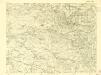
III. vojenské mapování 3956/3
1 : 25000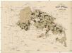
Uibersichtskarte der Daschitzer Domänenforste 1871
Dašice-oblast (Česko) Le-Monnier, Franz von Šafařík, Pavel Josef Verlag des böhm. Forst Vereins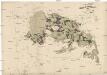
Uibersichtskarte der Daschitzer Domänenforste 1871
Dašice-oblast (Česko) Le-Monnier, Franz von Šafařík, Pavel Josef

Domäne Daschitz
1 : 57600