Maps of Ledenice

Zborov o. České Budějovice 1
1 : 2880
Mapa rozdělení pozemků dvora Mysletín po 1. pozemkové reformě, s vyznačením meliorací 1
1 : 5760
Ledenice o. České Budějovice 1
1 : 2880
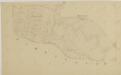
Situační plán silnice z Ledenic do Záluží 1

Zborow - c9182-1-007 - Kaiserpflichtexemplar der Landkarten des stabilen Katasters
1 : 2880
Zborow - c9182-1-003 - Kaiserpflichtexemplar der Landkarten des stabilen Katasters
1 : 2880
Zborow - c9182-1-005 - Kaiserpflichtexemplar der Landkarten des stabilen Katasters
1 : 2880
Zborow - c9182-1-002 - Kaiserpflichtexemplar der Landkarten des stabilen Katasters
1 : 2880
Zborow - c9182-1-001 - Kaiserpflichtexemplar der Landkarten des stabilen Katasters
1 : 2880
Zborow - c9182-1-006 - Kaiserpflichtexemplar der Landkarten des stabilen Katasters
1 : 2880
Zborow - c9182-1-004 - Kaiserpflichtexemplar der Landkarten des stabilen Katasters
1 : 2880
Porostní mapa polesí Zborov 1

Zborov o. České Budějovice 1
1 : 2880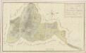
Geometrický plán dvora Mysletín se všemi přilehlými pozemky 1

Radostitz - c6377-1-003 - Kaiserpflichtexemplar der Landkarten des stabilen Katasters
1 : 2880
Radostitz - c6377-1-005 - Kaiserpflichtexemplar der Landkarten des stabilen Katasters
1 : 2880
Radostitz - c6377-1-001 - Kaiserpflichtexemplar der Landkarten des stabilen Katasters
1 : 2880
Radostitz - c6377-1-002 - Kaiserpflichtexemplar der Landkarten des stabilen Katasters
1 : 2880
Radostitz - c6377-1-004 - Kaiserpflichtexemplar der Landkarten des stabilen Katasters
1 : 2880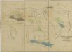
Mapy činžovních pozemků IV. sekce třeboňského velkostatku pro obce: Doudleby, Hodovice, Ledenice, Miletín, Nový Dvůr, Petrovice, Štěpánovice, Zborov 1
Ledenice o. České Budějovice 1
1 : 2880
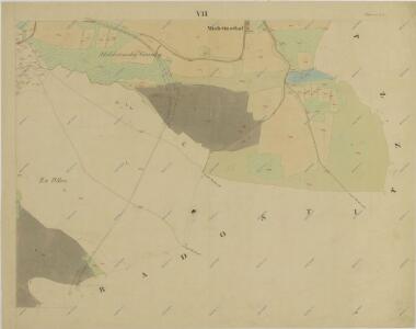
Radostitz, Budweiser Kr[eis]
1 : 2880 Radostice (Borovany, České Budějovice, Česko)
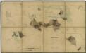
Generální mapa panství Třeboň a inkorporovaných statků Bzí, Lomnice, Borovany, Třeboň, Hamr a Val 1
Porostní mapa polesí Zborov 1
1 : 15000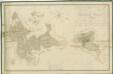
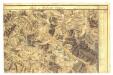
Přehledná mapa polesí Ledenice 1

Gradkartenblatt
1 : 25000 Borovany-oblast (České Budějovice, Česko) Gerstner, Eduard von
Topographische Karte ... Herrschaft Krummau ...

Topographische Karte der in Böhmen budweiser Kreises liegenden