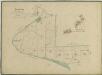
Maps of Majdalena

Herda o. Jindřichův Hradec 1
1 : 2880
Mapy činžovních pozemků obce Herda, spadající do III. sekce třeboňského velkostatku 1
Cep o. Jindřichův Hradec 1
1 : 2880
Branná o. Jindřichův Hradec 1
1 : 2880
Plán odbočky Mlýnské stoky ze Zlaté stoky u jednotáře Sklenáře

Hospodářská mapa polesí Cep 1

Geometrický plán polesí Cep
Mapy činžovních pozemků V. sekce třeboňského velkostatku pro obce: Cep, Hrdlořezy, Jílovice, Kramolín, Šalmanovice 1

Porostní obrysová mapa polesí Barbora 1
1 : 10000
Přehledná map polesí Cep s vyznačením hranic honiteb 1

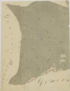
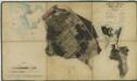
Herda - c4353-2-003 - Kaiserpflichtexemplar der Landkarten des stabilen Katasters
1 : 2880
Herda - c4353-2-002 - Kaiserpflichtexemplar der Landkarten des stabilen Katasters
1 : 2880
Herda - c4353-2-008 - Kaiserpflichtexemplar der Landkarten des stabilen Katasters
1 : 2880
Herda - c4353-2-004 - Kaiserpflichtexemplar der Landkarten des stabilen Katasters
1 : 2880
Herda - c4353-2-006 - Kaiserpflichtexemplar der Landkarten des stabilen Katasters
1 : 2880
Herda - c4353-2-007 - Kaiserpflichtexemplar der Landkarten des stabilen Katasters
1 : 2880
Herda - c4353-2-005 - Kaiserpflichtexemplar der Landkarten des stabilen Katasters
1 : 2880
Herda - c4353-2-009 - Kaiserpflichtexemplar der Landkarten des stabilen Katasters
1 : 2880
Herda - c4353-2-001 - Kaiserpflichtexemplar der Landkarten des stabilen Katasters
1 : 2880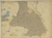
Přehledná hospodářská mapa velkostatku Třeboň 1
1 : 11250
Generální mapa panství Třeboň a inkorporovaných statků Bzí, Lomnice, Borovany, Třeboň, Hamr a Val 1

Geometrický plán vrchnostenských lesů v polesí Cep

Porostní mapa polesí Cep 1

Porostní mapa polesí Cep 1
Porostní mapa polesí Zámecké 1

Geometrický plán lesů u Vobůrky, Dlouhý vochoz u Březových můstků a u Černého kusu s přilehlými deputátními loukami a činžovními pozemky

Cep o. Jindřichův Hradec 1
1 : 2880
Hospodářská mapa polesí Cep 1

Geometrický plán polesí Cep