Maps of Majdalena

Mapy činžovních pozemků III. sekce třeboňského velkostatku pro obce: Břilice, Domanín, Herda, Holičky, Kojákovice, Spolí, Třeboň 1
1 : 2880
Mapy činžovních pozemků III. sekce třeboňského velkostatku pro obce: Branná, Břilice, Domanín, Herda, Holičky, Kojákovice, Spolí, Třeboň 1

Hospodářská mapa polesí Zámecký 1
1 : 5760
Hospodářská mapa polesí Zámecký 1
Geometrický plán činžovních a jiterních pozemků jednotářů u Nové Řeky

Holičky o. Jindřichův Hradec 1
1 : 2880
Geometrický plán lesa Vochozka a deputátních pozemků baštýře na Nové Řece

Cep o. Jindřichův Hradec 1
1 : 2880
Herda - c4353-2-003 - Kaiserpflichtexemplar der Landkarten des stabilen Katasters
1 : 2880
Herda - c4353-2-002 - Kaiserpflichtexemplar der Landkarten des stabilen Katasters
1 : 2880
Herda - c4353-2-008 - Kaiserpflichtexemplar der Landkarten des stabilen Katasters
1 : 2880
Herda - c4353-2-004 - Kaiserpflichtexemplar der Landkarten des stabilen Katasters
1 : 2880
Herda - c4353-2-006 - Kaiserpflichtexemplar der Landkarten des stabilen Katasters
1 : 2880
Herda - c4353-2-007 - Kaiserpflichtexemplar der Landkarten des stabilen Katasters
1 : 2880
Herda - c4353-2-005 - Kaiserpflichtexemplar der Landkarten des stabilen Katasters
1 : 2880
Herda - c4353-2-009 - Kaiserpflichtexemplar der Landkarten des stabilen Katasters
1 : 2880
Herda - c4353-2-001 - Kaiserpflichtexemplar der Landkarten des stabilen Katasters
1 : 2880
Porostní obrysová mapa polesí Barbora 1
1 : 10000
Porostní mapa polesí Zámecké 1

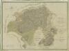
Generální mapa panství Třeboň a inkorporovaných statků Bzí, Lomnice, Borovany, Třeboň, Hamr a Val 1

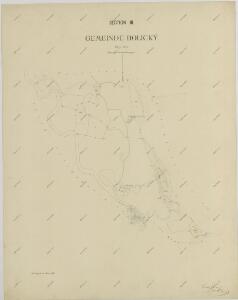
Mapy činžovních pozemků obce Herda, spadající do III. sekce třeboňského velkostatku 1

Geometrický plán vrchnostenských lesů v polesí Cep

Porostní mapa polesí Cep 1

Porostní mapa polesí Cep 1

Přehledná mapa polesí Cep
Přehledná mapa polesí Cep

Přehledná mapa polesí Cep

Geometrický plán polesí Cep
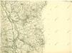
III. vojenské mapování 4454/1
1 : 25000