Maps of Chraštice
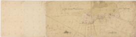
Mapa dvora Řeteč 1
1 : 2880
Mapa dvora Řeteč 1
1 : 5760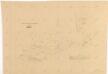
Mapa dvora Řeteč 1
1 : 5760
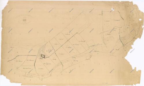
Chraštice s Chraštičkami a Řetčí, okr. Písek, list 7 1

Gross Chraschtitz - c2647-1-005 - Kaiserpflichtexemplar der Landkarten des stabilen Katasters
1 : 2880
Gross Chraschtitz - c2647-1-004 - Kaiserpflichtexemplar der Landkarten des stabilen Katasters
1 : 2880
Gross Chraschtitz - c2647-1-001 - Kaiserpflichtexemplar der Landkarten des stabilen Katasters
1 : 2880
Gross Chraschtitz - c2647-1-003 - Kaiserpflichtexemplar der Landkarten des stabilen Katasters
1 : 2880
Gross Chraschtitz - c2647-1-002 - Kaiserpflichtexemplar der Landkarten des stabilen Katasters
1 : 2880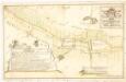
Geometrický nárys části hranic mezi panstvím orlickým a statkem Bukovany z r. 1766, díl C 1

Swuschitz - c7663-1-002 - Kaiserpflichtexemplar der Landkarten des stabilen Katasters
1 : 2880
Swuschitz - c7663-1-001 - Kaiserpflichtexemplar der Landkarten des stabilen Katasters
1 : 2880
Mapa dvora Chraštiček 1

Tauschkow - c7950-1-001 - Kaiserpflichtexemplar der Landkarten des stabilen Katasters
1 : 2880
Výřez z přehledné mapy velkostatku Orlíka z r. 1913 s vyznačením pozemků dvorů Horosedly, Lety, Mirovice a Nerestce 1
1 : 25000
Zalužan - c9120-1-002 - Kaiserpflichtexemplar der Landkarten des stabilen Katasters
1 : 2880
Zalužan - c9120-1-003 - Kaiserpflichtexemplar der Landkarten des stabilen Katasters
1 : 2880
Zalužan - c9120-1-001 - Kaiserpflichtexemplar der Landkarten des stabilen Katasters
1 : 2880
Zalužan - c9120-1-005 - Kaiserpflichtexemplar der Landkarten des stabilen Katasters
1 : 2880
Zalužan - c9120-1-004 - Kaiserpflichtexemplar der Landkarten des stabilen Katasters
1 : 2880
Mapa dvora Zalužany 1

Kozarowitz - c3442-1-004 - Kaiserpflichtexemplar der Landkarten des stabilen Katasters
1 : 2880
Kozarowitz - c3442-1-003 - Kaiserpflichtexemplar der Landkarten des stabilen Katasters
1 : 2880
Kozarowitz - c3442-1-002 - Kaiserpflichtexemplar der Landkarten des stabilen Katasters
1 : 2880
Kozarowitz - c3442-1-001 - Kaiserpflichtexemplar der Landkarten des stabilen Katasters
1 : 2880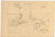
Mapa dvora Zalužany, list 2 1
1 : 1440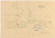
Mapa dvora Zalužany 1
1 : 5760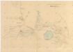
Mapa dvora Zalužany 1
1 : 5760
Chraštice s Chraštičkami a Řetčí, okr. Písek, list 1 1