Maps of Třeboc

Hospodářská mapa polesí Domoušice z roku 1887, list 3 3
1 : 2880
Hraniční mapa lesních parcel v katastru obce Lhota pod Džbánem, list 2 1
1 : 2880
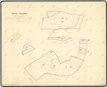
Wellhotten (Welhotta) - c3935-1-003 - Kaiserpflichtexemplar der Landkarten des stabilen Katasters
1 : 2880
Wellhotten (Welhotta) - c3935-1-002 - Kaiserpflichtexemplar der Landkarten des stabilen Katasters
1 : 2880
Wellhotten (Welhotta) - c3935-1-001 - Kaiserpflichtexemplar der Landkarten des stabilen Katasters
1 : 2880
Kopie katastrální mapy obce Třeboc z roku 1841, list II 1

Hraniční mapa lesních parcel v katastru obce Ročov 1
1 : 2880
Hospodářská mapa polesí Domoušice z roku 1887, list 2 2
1 : 2880
Mapa činžovních pozemků v polesí Domoušice, sekce 2 1

Hospodářská mapa polesí Domoušice z roku 1926/1927, list 2 2
1 : 2880
Záměrná mapa polesí Domoušice, sekce 3 3

Trzebotz (Třeboc) - c8039-1-003 - Kaiserpflichtexemplar der Landkarten des stabilen Katasters
1 : 2880
Trzebotz (Třeboc) - c8039-1-006 - Kaiserpflichtexemplar der Landkarten des stabilen Katasters
1 : 2880
Trzebotz (Třeboc) - c8039-1-002 - Kaiserpflichtexemplar der Landkarten des stabilen Katasters
1 : 2880
Trzebotz (Třeboc) - c8039-1-007 - Kaiserpflichtexemplar der Landkarten des stabilen Katasters
1 : 2880
Trzebotz (Třeboc) - c8039-1-005 - Kaiserpflichtexemplar der Landkarten des stabilen Katasters
1 : 2880
Trzebotz (Třeboc) - c8039-1-001 - Kaiserpflichtexemplar der Landkarten des stabilen Katasters
1 : 2880
Trzebotz (Třeboc) - c8039-1-004 - Kaiserpflichtexemplar der Landkarten des stabilen Katasters
1 : 2880
Bestandeskarte für die Excursion des böhmischen Forstvereins im Domaušicer Forstbezirke im Jahre 1881
Domoušice (Česko) Saitz, August Musis, Julius de Verlag des böhm. Forstvereins
Předloha hospodářské mapy polesí Domoušice 1

Porostní mapa polesí Domoušice 1
1 : 10000
Porostní mapa polesí Domoušice 1

Porostní mapa polesí Domoušice 1
1 : 10000
Porostní mapa polesí Domoušice 1
1 : 10000
Porostní mapa polesí Domoušice 1
1 : 10000
Obrysová mapa polesí Domoušice s hranicemi pozemkové reformy 1
1 : 10000
Porostní mapa polesí Domoušice 1
1 : 10000
Porostní mapa polesí Domoušice, druhý exemplář 1
1 : 10000
Porostní mapa polesí Třeboc 1