Maps of Stará Voda
Hospodářská mapa revírů Slatina a Tři Sekery
1 : 3256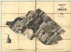
Porostní mapa revíru Slatina
1 : 11520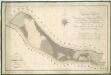
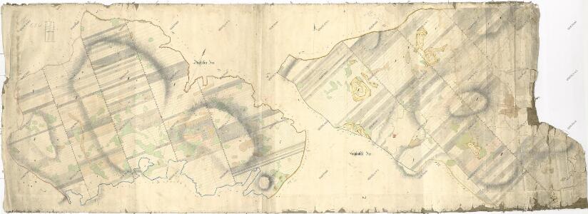
Hospodářská mapa revíru Plánská Huť
1 : 4377
Hospodářská mapa revíru Plánská Huť
1 : 8640
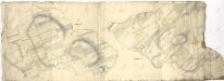
Brouillon hospodářské mapy revíru Plánská Huť
1 : 2880
Katastrální mapa obce Tři Sekery WC-XVI-17 bi
1 : 2880
Katastrální mapa obce Tři Sekery WC-XVI-18 ae
1 : 2880
Katastrální mapa obce Tři Sekery WC-XVI-17 ai
1 : 2880
Hospodářská a porostní mapa revíru Plánská Huť
1 : 4350
Katastrální mapa obce Tři Sekery WC-XVI-18 be
1 : 2880
Hospodářská mapa revíru Plánská Huť
1 : 8640
Katastrální mapa obce Tři Sekery WC-XV-17 di
1 : 2880
Katastrální mapa obce Tři Sekery WC-XV-18 de
1 : 2880
Hospodářská a porostní mapa revíru Plánská Huť
1 : 2880
Lesní mapa sekce č. IV revíru Slatina, část hranice sousedící s pozemky obce Slatina
1 : 3612
Brouillon hospodářské mapy revíru Plánská Huť
1 : 2880
Katastrální mapa obce Tři Sekery WC-XVI-17 ah
1 : 2880
Katastrální mapa obce Tři Sekery WC-XVI-18 ce
1 : 2880
Mapa prodaných, směněných a darovaných pozemků v katastru obce Slatina
1 : 2880
Hospodářská a porostní mapa revíru Plánská Huť
1 : 2880
Plán revíru Tři Sekery
1 : 4742
Porostní mapa revíru Tři Sekery-Lohhäuser
1 : 11520
Dreyhacken - c8080-1-010 - Kaiserpflichtexemplar der Landkarten des stabilen Katasters
1 : 2880
Dreyhacken - c8080-1-005 - Kaiserpflichtexemplar der Landkarten des stabilen Katasters
1 : 2880
Dreyhacken - c8080-1-017 - Kaiserpflichtexemplar der Landkarten des stabilen Katasters
1 : 2880
Dreyhacken - c8080-1-002 - Kaiserpflichtexemplar der Landkarten des stabilen Katasters
1 : 2880
Dreyhacken - c8080-1-004 - Kaiserpflichtexemplar der Landkarten des stabilen Katasters
1 : 2880
Dreyhacken - c8080-1-011 - Kaiserpflichtexemplar der Landkarten des stabilen Katasters
1 : 2880
Dreyhacken - c8080-1-015 - Kaiserpflichtexemplar der Landkarten des stabilen Katasters
1 : 2880
Dreyhacken - c8080-1-001 - Kaiserpflichtexemplar der Landkarten des stabilen Katasters
1 : 2880
Dreyhacken - c8080-1-006 - Kaiserpflichtexemplar der Landkarten des stabilen Katasters
1 : 2880
Dreyhacken - c8080-1-007 - Kaiserpflichtexemplar der Landkarten des stabilen Katasters
1 : 2880
Dreyhacken - c8080-1-016 - Kaiserpflichtexemplar der Landkarten des stabilen Katasters
1 : 2880
Dreyhacken - c8080-1-012 - Kaiserpflichtexemplar der Landkarten des stabilen Katasters
1 : 2880
Dreyhacken - c8080-1-018 - Kaiserpflichtexemplar der Landkarten des stabilen Katasters
1 : 2880
Dreyhacken - c8080-1-014 - Kaiserpflichtexemplar der Landkarten des stabilen Katasters
1 : 2880
Dreyhacken - c8080-1-008 - Kaiserpflichtexemplar der Landkarten des stabilen Katasters
1 : 2880
Dreyhacken - c8080-1-013 - Kaiserpflichtexemplar der Landkarten des stabilen Katasters
1 : 2880
Dreyhacken - c8080-1-003 - Kaiserpflichtexemplar der Landkarten des stabilen Katasters
1 : 2880