Maps of Tři Sekery

Hospodářská a porostní mapa revíru Plánská Huť
1 : 2880
Kuttenplaner-Schmelzthal - c2557-2-006 - Kaiserpflichtexemplar der Landkarten des stabilen Katasters
1 : 2880
Kuttenplaner-Schmelzthal - c2557-2-003 - Kaiserpflichtexemplar der Landkarten des stabilen Katasters
1 : 2880
Kuttenplaner-Schmelzthal - c2557-2-002 - Kaiserpflichtexemplar der Landkarten des stabilen Katasters
1 : 2880
Kuttenplaner-Schmelzthal - c2557-2-004 - Kaiserpflichtexemplar der Landkarten des stabilen Katasters
1 : 2880
Kuttenplaner-Schmelzthal - c2557-2-005 - Kaiserpflichtexemplar der Landkarten des stabilen Katasters
1 : 2880
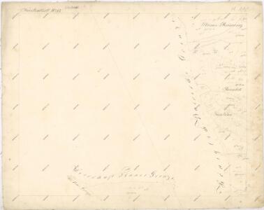
Kuttenplaner-Schmelzthal - c2557-2-001 - Kaiserpflichtexemplar der Landkarten des stabilen Katasters
1 : 2880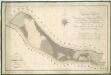
Hospodářská mapa revíru Plánská Huť
1 : 4377
Brouillon hospodářské mapy revíru Plánská Huť
1 : 2880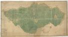
Plán revíru Tři Sekery
1 : 4742
III. vojenské mapování 4049/1
1 : 25000
Gradkartenblatt
1 : 25000 Čechy (Česko) Böhm, Karl
[Kartenblatt]
1 : 25000 Mähring (Německo) Reichsamt für Landesaufnahme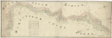
Mapa česko-bavorské hranice v prostoru panství Tachov, Planá a Chodová Planá
1 : 12842

Umgebungskarte der Curstadt Marienbad
1 : 60000 Mariánské Lázně-oblast (Česko) E.A. Götz
Bavaria 1:50,000, Tirschenreuth (East)
Bavaria 1:50 000, Series GSGS 4492. Great Britain. Ordnance Survey. [London] : War Office
Umgebungskarte der Kurstadt Marienbad
1 : 50000 Mariánské Lázně-oblast (Česko) E.A. Götz
Hayder Vicariat
Bor-oblast (Tachov, Česko)
Marienbad und Tachau
1 : 75000 Mariánské Lázně (Česko : oblast) Höller, K. K. u. k. Militärgeographisches Institut
Marienbad und Tachau
1 : 75000 Mariánské Lázně (Česko : oblast) K. u. k. Militärgeographisches Institut
Přehledová mapa velkostatku Tachov
1 : 17280
Mariánské Lázně
1 : 75000 Chodová Planá (Česko : oblast) Vojenský zeměpisný ústav
Mariánské Lázně
1 : 75000 Mariánské Lázně (Česko : oblast) Vojenský zeměpisný ústav
Mariánské Lázně
1 : 75000 Mariánské Lázně-oblast (Česko) Vojenský zeměpisný ústav
III. vojenské mapování 4049
1 : 75000
Mappa chorographica districtvs Egerani
1 : 113000 Cheb-oblast (Česko) Müller, Johann Christoph
Mappa chorographica districtvs Egerani
1 : 113000 Cheb-oblast (Česko) Müller, Johann Christoph Weigel, Christoph
Vilímkovy místopisné mapy zemí Koruny české
1 : 100000 Chodová Planá (Česko : oblast) Srp, Jan Jos. R. Vilímek