Maps of Skapce
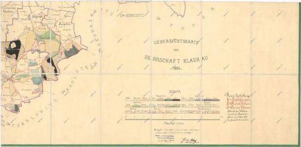
Přehledová mapa velkostatku Kladruby
1 : 17280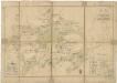
Plán dvora Zálezly
1 : 6018
Gibian (Borowany) - c2945-1-001 - Kaiserpflichtexemplar der Landkarten des stabilen Katasters
1 : 2880
Gibian (Borowany) - c2945-1-004 - Kaiserpflichtexemplar der Landkarten des stabilen Katasters
1 : 2880
Gibian (Borowany) - c2945-1-002 - Kaiserpflichtexemplar der Landkarten des stabilen Katasters
1 : 2880
Gibian (Borowany) - c2945-1-003 - Kaiserpflichtexemplar der Landkarten des stabilen Katasters
1 : 2880
Guratin (Krtino) - c3580-1-002 - Kaiserpflichtexemplar der Landkarten des stabilen Katasters
1 : 2880
Guratin (Krtino) - c3580-1-001 - Kaiserpflichtexemplar der Landkarten des stabilen Katasters
1 : 2880
Kapsch (Skapecz) - c6926-1-003 - Kaiserpflichtexemplar der Landkarten des stabilen Katasters
1 : 2880
Kapsch (Skapecz) - c6926-1-001 - Kaiserpflichtexemplar der Landkarten des stabilen Katasters
1 : 2880
Kapsch (Skapecz) - c6926-1-004 - Kaiserpflichtexemplar der Landkarten des stabilen Katasters
1 : 2880
Kapsch (Skapecz) - c6926-1-002 - Kaiserpflichtexemplar der Landkarten des stabilen Katasters
1 : 2880
Katastrální mapa obce Krtín
1 : 2880
Plán dvora Jivjany
1 : 7591
Czarlowitz (Černojce) - c0909-1-001 - Kaiserpflichtexemplar der Landkarten des stabilen Katasters
1 : 2880
Czarlowitz (Černojce) - c0909-1-003 - Kaiserpflichtexemplar der Landkarten des stabilen Katasters
1 : 2880
Czarlowitz (Černojce) - c0909-1-002 - Kaiserpflichtexemplar der Landkarten des stabilen Katasters
1 : 2880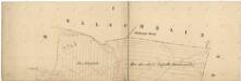
Katastrální mapa obce Krtín
1 : 2880
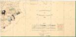
Hospodářská mapa revíru Jivjany
1 : 5760
Katastrální mapa obce Skapce
1 : 2880
Radlstein (Hradjsstanj) - c2316-1-001 - Kaiserpflichtexemplar der Landkarten des stabilen Katasters
1 : 2880
Radlstein (Hradjsstanj) - c2316-1-005 - Kaiserpflichtexemplar der Landkarten des stabilen Katasters
1 : 2880
Radlstein (Hradjsstanj) - c2316-1-002 - Kaiserpflichtexemplar der Landkarten des stabilen Katasters
1 : 2880
Radlstein (Hradjsstanj) - c2316-1-003 - Kaiserpflichtexemplar der Landkarten des stabilen Katasters
1 : 2880
Radlstein (Hradjsstanj) - c2316-1-004 - Kaiserpflichtexemplar der Landkarten des stabilen Katasters
1 : 2880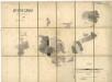
Porostní mapa revíru Jivjany
1 : 11520
Nedraschitz (Nedražice) - c5000-1-001 - Kaiserpflichtexemplar der Landkarten des stabilen Katasters
1 : 2880
Nedraschitz (Nedražice) - c5000-1-003 - Kaiserpflichtexemplar der Landkarten des stabilen Katasters
1 : 2880
Nedraschitz (Nedražice) - c5000-1-002 - Kaiserpflichtexemplar der Landkarten des stabilen Katasters
1 : 2880