Maps of Žihle

Katastrální mapa obce Hluboká ZSL-VIII-16 ch
1 : 2880
Hlubocka (Hluboky) - c1890-1-001 - Kaiserpflichtexemplar der Landkarten des stabilen Katasters
1 : 2880
Hlubocka (Hluboky) - c1890-1-003 - Kaiserpflichtexemplar der Landkarten des stabilen Katasters
1 : 2880
Hlubocka (Hluboky) - c1890-1-002 - Kaiserpflichtexemplar der Landkarten des stabilen Katasters
1 : 2880
Hospodářská mapa polesí Rabštejn-Kalec
1 : 11520
Kalletz (Kalec) - c2979-1-003 - Kaiserpflichtexemplar der Landkarten des stabilen Katasters
1 : 2880
Kalletz (Kalec) - c2979-1-002 - Kaiserpflichtexemplar der Landkarten des stabilen Katasters
1 : 2880
Kalletz (Kalec) - c2979-1-001 - Kaiserpflichtexemplar der Landkarten des stabilen Katasters
1 : 2880
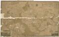
Schelles (Žhile) - c9431-1-006 - Kaiserpflichtexemplar der Landkarten des stabilen Katasters
1 : 2880
Schelles (Žhile) - c9431-1-002 - Kaiserpflichtexemplar der Landkarten des stabilen Katasters
1 : 2880
Schelles (Žhile) - c9431-1-003 - Kaiserpflichtexemplar der Landkarten des stabilen Katasters
1 : 2880
Schelles (Žhile) - c9431-1-005 - Kaiserpflichtexemplar der Landkarten des stabilen Katasters
1 : 2880
Schelles (Žhile) - c9431-1-004 - Kaiserpflichtexemplar der Landkarten des stabilen Katasters
1 : 2880
Schelles (Žhile) - c9431-1-001 - Kaiserpflichtexemplar der Landkarten des stabilen Katasters
1 : 2880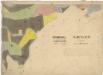
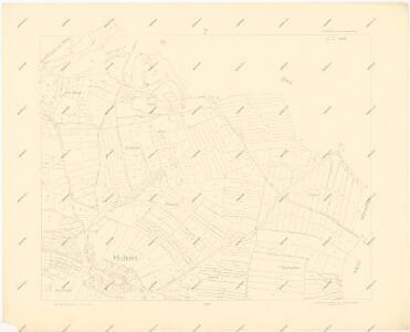
Katastrální mapa města Rabštejn
1 : 2880
Porostní mapa polesí Kalec
1 : 5760
Katastrální mapa města Rabštejn WC-VIII-16 dh ch
1 : 2880
Mapa výhradních kutišť knížete Richarda von Metternich u Žihle
1 : 2918
Generální mapa panství Plasy se statkem Krašov (bez Kaceřova a Horní Bělé)
1 : 11611
Přehledná mapa velkostatku Manětín podle stavu k roku 1905
1 : 37500
Situační plán hájoven náležejících k panství Plasy
1 : 25000
[Umgebung von Kralowitz]
1 : 75000 Kralovice (Plzeň-sever, Česko : oblast) K. u. k. Militärgeographisches Institut
Kralovice a okolí
1 : 75000 Kralovice (Plzeň-sever, Česko : oblast) Vojenský zeměpisný ústav
Podersam und Rakonitz
1 : 75000 Podbořany (Česko : oblast) K. u. k. Militärgeographisches Institut
Podersam und Rakonitz
1 : 75000 Podbořany (Česko : oblast) Hertel, A. K. u. k. militär-geographisches Institut
Podersam und Rakonitz
1 : 75000 Podbořany (Česko : oblast) Hertel, A. K. u. k. Militärgeographisches Institut
Podersam und Rakonitz
1 : 75000 Podbořany (Česko : oblast) K. u. k. Militärgeographisches Institut
Karlovy Vary
1 : 75000 Karlovy Vary-oblast (Česko) Vojenský zeměpisný ústav