Maps of Dražeň

Katastrální mapa obce Dražeň
1 : 2880
Záměrná mapa polesí Lomany
1 : 5000
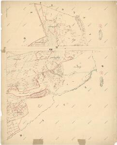
Draschen (Dražen) - c1514-1-001 - Kaiserpflichtexemplar der Landkarten des stabilen Katasters
1 : 2880
Draschen (Dražen) - c1514-1-003 - Kaiserpflichtexemplar der Landkarten des stabilen Katasters
1 : 2880
Draschen (Dražen) - c1514-1-004 - Kaiserpflichtexemplar der Landkarten des stabilen Katasters
1 : 2880
Draschen (Dražen) - c1514-1-005 - Kaiserpflichtexemplar der Landkarten des stabilen Katasters
1 : 2880
Draschen (Dražen) - c1514-1-002 - Kaiserpflichtexemplar der Landkarten des stabilen Katasters
1 : 2880
Lomiczka (Lomička) - c4221-1-006 - Kaiserpflichtexemplar der Landkarten des stabilen Katasters
1 : 2880
Lomiczka (Lomička) - c4221-1-002 - Kaiserpflichtexemplar der Landkarten des stabilen Katasters
1 : 2880
Lomiczka (Lomička) - c4221-1-004 - Kaiserpflichtexemplar der Landkarten des stabilen Katasters
1 : 2880
Lomiczka (Lomička) - c4221-1-003 - Kaiserpflichtexemplar der Landkarten des stabilen Katasters
1 : 2880
Lomiczka (Lomička) - c4221-1-008 - Kaiserpflichtexemplar der Landkarten des stabilen Katasters
1 : 2880
Lomiczka (Lomička) - c4221-1-007 - Kaiserpflichtexemplar der Landkarten des stabilen Katasters
1 : 2880
Lomiczka (Lomička) - c4221-1-005 - Kaiserpflichtexemplar der Landkarten des stabilen Katasters
1 : 2880
Lomiczka (Lomička) - c4221-1-001 - Kaiserpflichtexemplar der Landkarten des stabilen Katasters
1 : 2880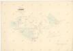
Mapa pozemků dvora Lomany v katastru obce Lomnička
1 : 5760
Katastrální mapa obce Lomnička
1 : 2880
Porostní mapa polesí Lomany
1 : 2918
Mapa polesí Lomany
1 : 5000
Katastrální mapa obce Dražeň
1 : 2880
III. vojenské mapování 4050/2
1 : 25000
[Kartenblatt]
1 : 25000 Dolní Bělá (Česko : oblast) Reichsamt für Landesaufnahme
Gradkartenblatt
1 : 25000 Manětín-oblast (Česko) Brzesina, Julius von

Přehledná mapa velkostatku Manětín podle stavu k roku 1905
1 : 37500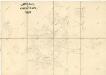
Generální mapa lesů velkostatku Plasy
1 : 13186
Situační plán hájoven náležejících k panství Plasy
1 : 25000
III. vojenské mapování 4050
1 : 75000
[Umgebung von Kralowitz]
1 : 75000 Kralovice (Plzeň-sever, Česko : oblast) K. u. k. Militärgeographisches Institut