Maps of Vejprnice

Katastrální mapa obce Vejprnice WC-VIII-20 de 21 df
1 : 2880
Porostní mapa revíru Vejprnice
1 : 2880
Skurnian (Skurnanj) - c6987-1-003 - Kaiserpflichtexemplar der Landkarten des stabilen Katasters
1 : 2880
Skurnian (Skurnanj) - c6987-1-005 - Kaiserpflichtexemplar der Landkarten des stabilen Katasters
1 : 2880
Skurnian (Skurnanj) - c6987-1-002 - Kaiserpflichtexemplar der Landkarten des stabilen Katasters
1 : 2880
Skurnian (Skurnanj) - c6987-1-001 - Kaiserpflichtexemplar der Landkarten des stabilen Katasters
1 : 2880
Skurnian (Skurnanj) - c6987-1-004 - Kaiserpflichtexemplar der Landkarten des stabilen Katasters
1 : 2880
Skurnian (Skurnanj) - c6987-1-006 - Kaiserpflichtexemplar der Landkarten des stabilen Katasters
1 : 2880
Porostní mapa revíru Vejprnice
1 : 8640
Weiprnitz (Wegprnic) - c8346-1-004 - Kaiserpflichtexemplar der Landkarten des stabilen Katasters
1 : 2880
Weiprnitz (Wegprnic) - c8346-1-005 - Kaiserpflichtexemplar der Landkarten des stabilen Katasters
1 : 2880
Weiprnitz (Wegprnic) - c8346-1-003 - Kaiserpflichtexemplar der Landkarten des stabilen Katasters
1 : 2880
Weiprnitz (Wegprnic) - c8346-1-002 - Kaiserpflichtexemplar der Landkarten des stabilen Katasters
1 : 2880
Weiprnitz (Wegprnic) - c8346-1-001 - Kaiserpflichtexemplar der Landkarten des stabilen Katasters
1 : 2880
Katastrální mapa obce Křimice
1 : 2880
Katastrální mapa obce Křimice
1 : 2880
Pilsen (Plzeň)

Plán královského města Plzně : příloha k Adresáři města Plzně 1905
Plán města Plzně s vyznačenými bloky domů, významnými stavbami, průmyslovými podniky - očíslováno, celkem 146 položek rozdělených do několika kategorií. Vysvětlivky kolem plánu, seznam ulic, rozdělení města. V levém rohu plánek vilové čtvrti Lochotín.
Plán král[ovské] Plzně a okolí
Plzeň (Česko : oblast) Jos. Novák a F. J. Šašek
Záměrná mapa pozemků a rybníků dvora Pořejov
1 : 5760
Plán města Plzně
1 : 15000 Plzeň (Česko : oblast) Klub československých turistů
Plán král[ovského] města Plzně
1 : 15000 Plzeň (Česko : oblast) Klub českých turistů
[Kartenblatt]
1 : 25000 Chlumčany (Plzeň-jih, Česko : oblast) Reichsamt für Landesaufnahme
III. vojenské mapování 4150/2
1 : 25000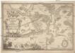
Ordre de Battaliae dero Röm. Kay. Majtt. Campament bey Pilsen in Königreich Böheimb, bestehende in 17 Battallions und 13. Granadiers Compagnien auch 28. Esqvadrons Curassiers 14 Esqvadrons Dragoner, 6. Esqvadrons Hussare[n], und 22 feld-stucke
1 : 45000 Plzeň-oblast (Česko) Ditzler, Joann Josef Birkhard, Antonín Birckhart
Gradkartenblatt
1 : 25000 Nýřany-oblast (Česko) Bulla, Eduard
Povodeň ve středních Čechách dne 25. a 26. května 1872

Geologická mapa jižní části plzeňské pánve kamenouhelné