Maps of Staré Sedlo
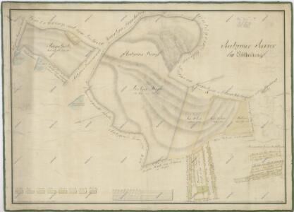
Mapa revíru Racov
1 : 2616
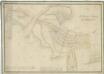
Porostní mapa revíru Sedmihoří
1 : 10000
Porostní mapa revíru Sedmihoří
1 : 20000
Ratzau - c6303-1-004 - Kaiserpflichtexemplar der Landkarten des stabilen Katasters
1 : 2880
Ratzau - c6303-1-001 - Kaiserpflichtexemplar der Landkarten des stabilen Katasters
1 : 2880
Ratzau - c6303-1-002 - Kaiserpflichtexemplar der Landkarten des stabilen Katasters
1 : 2880
Ratzau - c6303-1-003 - Kaiserpflichtexemplar der Landkarten des stabilen Katasters
1 : 2880
Wiedlitz - c8564-1-002 - Kaiserpflichtexemplar der Landkarten des stabilen Katasters
1 : 2880
Wiedlitz - c8564-1-003 - Kaiserpflichtexemplar der Landkarten des stabilen Katasters
1 : 2880
Wiedlitz - c8564-1-001 - Kaiserpflichtexemplar der Landkarten des stabilen Katasters
1 : 2880
Darmschlag - c1066-1-002 - Kaiserpflichtexemplar der Landkarten des stabilen Katasters
1 : 2880
Darmschlag - c1066-1-006 - Kaiserpflichtexemplar der Landkarten des stabilen Katasters
1 : 2880
Darmschlag - c1066-1-001 - Kaiserpflichtexemplar der Landkarten des stabilen Katasters
1 : 2880
Darmschlag - c1066-1-004 - Kaiserpflichtexemplar der Landkarten des stabilen Katasters
1 : 2880
Darmschlag - c1066-1-005 - Kaiserpflichtexemplar der Landkarten des stabilen Katasters
1 : 2880
Darmschlag - c1066-1-007 - Kaiserpflichtexemplar der Landkarten des stabilen Katasters
1 : 2880
Darmschlag - c1066-1-003 - Kaiserpflichtexemplar der Landkarten des stabilen Katasters
1 : 2880

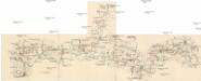
Přehledová mapa velkostatku Kladruby
1 : 52300

Mieser Vicariat
Stříbro-oblast (Česko)
III. vojenské mapování 4150
1 : 75000
Horšovský Týn
1 : 75000 Horšovský Týn-oblast (Česko) Vojenský zeměpisný ústav
Politický okres Tachov
1 : 75000 Tachov (Česko : okres : 1960-) Vojenský zeměpisný ústav
Politický okres Tachov
Böhmerwald-Verbindungsbahn
1 : 75000 Domažlice-Planá u Mariánských Lázní (Česko : železniční trať) Technisches Bureau Ing. Max Picha
Podrobná místopisná mapa Království Českého

Podrobná mapa Království českého
1 : 100000 Domažlice (Česko : oblast) Srp, Jan Jaroslav Bursík
II. vojenské mapování 23
1 : 144000