Maps of Staré Sedlo

Katastrální mapa obce Staré Sedlo
1 : 2880
Altsattl - c7280-1-003 - Kaiserpflichtexemplar der Landkarten des stabilen Katasters
1 : 2880
Altsattl - c7280-1-001 - Kaiserpflichtexemplar der Landkarten des stabilen Katasters
1 : 2880
Altsattl - c7280-1-004 - Kaiserpflichtexemplar der Landkarten des stabilen Katasters
1 : 2880
Altsattl - c7280-1-002 - Kaiserpflichtexemplar der Landkarten des stabilen Katasters
1 : 2880
Mapa pozemků dvora Bonětičky
1 : 4250
Turban - c0389-1-002 - Kaiserpflichtexemplar der Landkarten des stabilen Katasters
1 : 2880
Turban - c0389-1-001 - Kaiserpflichtexemplar der Landkarten des stabilen Katasters
1 : 2880
Turban - c0389-1-005 - Kaiserpflichtexemplar der Landkarten des stabilen Katasters
1 : 2880
Turban - c0389-1-004 - Kaiserpflichtexemplar der Landkarten des stabilen Katasters
1 : 2880
Turban - c0389-1-003 - Kaiserpflichtexemplar der Landkarten des stabilen Katasters
1 : 2880
Katastrální mapa obce Staré Sedlo
1 : 2880
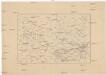
Přehledová mapa velkostatku Kladruby
1 : 17280
[Kartenblatt]
1 : 25000 Heřmanova Huť (Česko : oblast) Reichsamt für Landesaufnahme
III. vojenské mapování 4150/1
1 : 25000
Gradkartenblatt
1 : 25000 Kladruby-oblast (Tachov, Česko) Boruszczak, Theodor
Přehledová mapa velkostatku Kladruby
1 : 52300

Mieser Vicariat
Stříbro-oblast (Česko)
III. vojenské mapování 4150
1 : 75000
Stříbro a okolí
1 : 75000 Stříbro (Česko : oblast) Vojenský zeměpisný ústav
Horšovský Týn
1 : 75000 Horšovský Týn-oblast (Česko) Vojenský zeměpisný ústav
Politický okres Tachov
1 : 75000 Tachov (Česko : okres : 1960-) Vojenský zeměpisný ústav
Politický okres Tachov

Podrobná mapa Království českého
1 : 100000 Planá (Tachov, Česko : oblast) Srp, Jan Jaroslav Bursík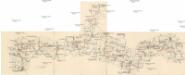
Böhmerwald-Verbindungsbahn
1 : 75000 Domažlice-Planá u Mariánských Lázní (Česko : železniční trať) Technisches Bureau Ing. Max Picha
Vilímkovy místopisné mapy zemí Koruny české
1 : 100000 Chodová Planá (Česko : oblast) Srp, Jan Jos. R. Vilímek
Tepl und Tuschkau.
from Spezialkarte der osterreichisch-ungarischen Monarchie.
Marienbad und Tachau.
from Spezialkarte der osterreichisch-ungarischen Monarchie.