Maps of Jaworzno

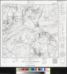
Meßtischblatt 5781 : Birkental, 1942
1 : 250000 Birkental. - Aufn. 1881, hrsg. 1888, letzte Nachtr. 1931, gedr. [19]42. - 1:25000. - [Berlin]: Reichsamt für Landesaufnahme, 1942. - 1 Kt.
147. Beuthen, uit: Topographische Uebersichtskarte des Deutschen Reiches / herausgegeben v. d. Kartogr. Abt. d. Königl. Preuß. Landesaufnahme
1 : 200000 titelvariant: Topogr. Übersichtskarte des Deutschen Reiches; Annotatie: Titel boven bladen ook: Topogr. Übersichtskarte des Deutschen Reiches; Annotatie geografische gegevens: Op elk blad twee maatstokken: 10 Kilometer = 5,5 cm; 1 geogr. Meile = 3,6 cm; Legenda onder op elk blad Königlich Preußische Landesaufnahme. Kartographische Abtheilung [S.l : Königlich Preußische Landesaufnahme, Kartographische Abtheilung]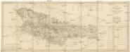
Karte des Gross-Herzogthums Krakau
1 : 114700 Krakov-oblast (Polsko) Liechtenstern, Joseph Marx von Kummersberg, Carl von Julius Wildt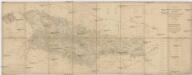
Karte des Gross-Herzogthums Krakau
1 : 114700 Krakov-oblast (Polsko) Liechtenstern, Joseph Marx von Kummersberg, Carl von Julius Wildt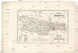
Karta okręgu wolnego miasta Krakowa
1 : 183000 Krakov-oblast (Polsko) Żebrawski, Theofil Friedlein, D. E. nakładem D.E. Friedleina
Karta okręgu wolnego miasta Krakowa
1 : 183000 Krakov-oblast (Polsko) Żebrawski, Theofil Friedlein, D. E. nakładem D.E. Friedleina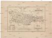
Karta okręgu wolnego miasta Krakowa
1 : 183000 Krakov-oblast (Polsko) Żebrawski, Theofil Friedlein, D. E. nakładem D.E. Friedleina

Karta przeglądowa polskiego zagłębia węglowego
1 : 300000 Polsko Sarjusz-Makowski, Arnold
Beuthen 92, uit: Special-Karte von Mittel-Europa / nach amtlichen Quellen bearbeitet von W. Liebenow
1 : 300000 titelvariant: W. Liebenow's Mittel-Europa; Annotatie: Titel boven de bladen: W. Liebenow's Mittel-Europa Johannes Wilhelm Liebenow 1822-1897 Frankfurt a. M. : Ludwig Ravenstein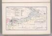
Coal Fields No. 8, Austria. Coal Resources of the World.
1 : 344800 Petrascheck, W.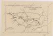
Sbírka map a diagramů použitých na mírových konferencích v Paříži v letech 1919 - 1920

Silésie de Teschen
1 : 200000 Cieszyn-oblast (Polsko) Čs. voj. zeměpis. ústav
Silésie de Teschen
Cieszyn-oblast (Polsko) Čs. voj. zeměpis. ústav
Silésie de Teschen
Cieszyn-oblast (Polsko) Čs. voj. zeměpis. ústav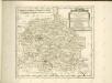

Kartographische Darstellung der Abstimmungs-Ergebnisse von Oberschlesien
1 : 100000 [im Auftrag des Auswärtigen Amtes bearb. in der Plankammer des Preußisch-Statistischen Landesamtes vom Gerke] ; mit Genehmigung der Landesaufnahme, Berlin Berlin : Berliner Lithographisches Institut
Mapa Górnego Śląska
1 : 600000 Horní Slezsko Gregor, Józef K. Miarka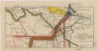
Sbírka map a diagramů použitých na mírových konferencích v Paříži v letech 1919 - 1920

West Galizien
Bochnia (Polsko) Müller, Karl Metzburg, Georg Ignaz von im Verlage des Kunst und Industrie Comptoirs
West Galizien
Halič (Polsko a Ukrajina) Müller, Karl Metzburg, Georg Ignaz von im Verlage des Kunst und Industrie Comptoirs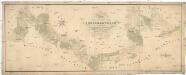
Situations Plan der trokenen Landesgraenze zwischen dem Weichsel und Pietruvka Flus von kais. koen. Oesterreich. Schlesien und koen. Preussisch Schlesien
1 : 10000 Visla-oblast (Polsko) Kuffay, Franz Engel
Sect. 21: Breslau, uit: Geologische Karte des Deutschen Reichs in 27 Blaettern / [von] Richard Lepsius ; Red. von C. Vogel
1 : 500000 Annotatie: Blad 18 ontbreekt; Een aantal bladen op linnen; Een aantal bladen gereviseerd 1913-1914; Annotatie geografische gegevens: Met schaalstokken o.a. in kilometers; Legenda Carl Vogel 1828-1897 Gotha : Justus Perthes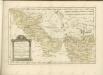

Kolonie założone za panowania Fryderyka Wielkiego na Śląsku pruskim
Polen Schlesien Preußen Stadtgründung Friedrich II.
Volební mapa do říšského sněmu
1 : 1000000 Morava (Česko) G. Freytag & Berndt
Novissima et accuratissima XVII Provinciarum Germaniae Inferioris Tabula
1 : 1500000 Mollova mapová sbírka Wit, Frederik de Deur, Abraham Janszoon Ottens, Josua
Novissima et accuratissima XVII Provinciarum Germaniae Inferioris Delineatio
1 : 1050000 Mollova mapová sbírka Schagen, Gerhardus Schagen, Gerhardus
Novissima et accuratissima XVII Provinciarum Germaniae Inferioris Delineatio
1 : 1500000 Mollova mapová sbírka Visscher, Nicolaes Deur, Abraham Janszoon Visscher, Nicolaus I.