Mappa catalogata


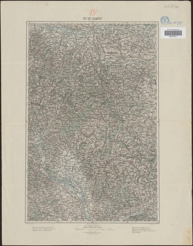
35°50° Olmütz / K.u.k. militär-geographisches Institut
1903
K.u.k. militär-geographisches Institut

Neuer Atlas Uber die Gantze Welt, mapa ze strany: [132]
1714
Homann Johann Baptist
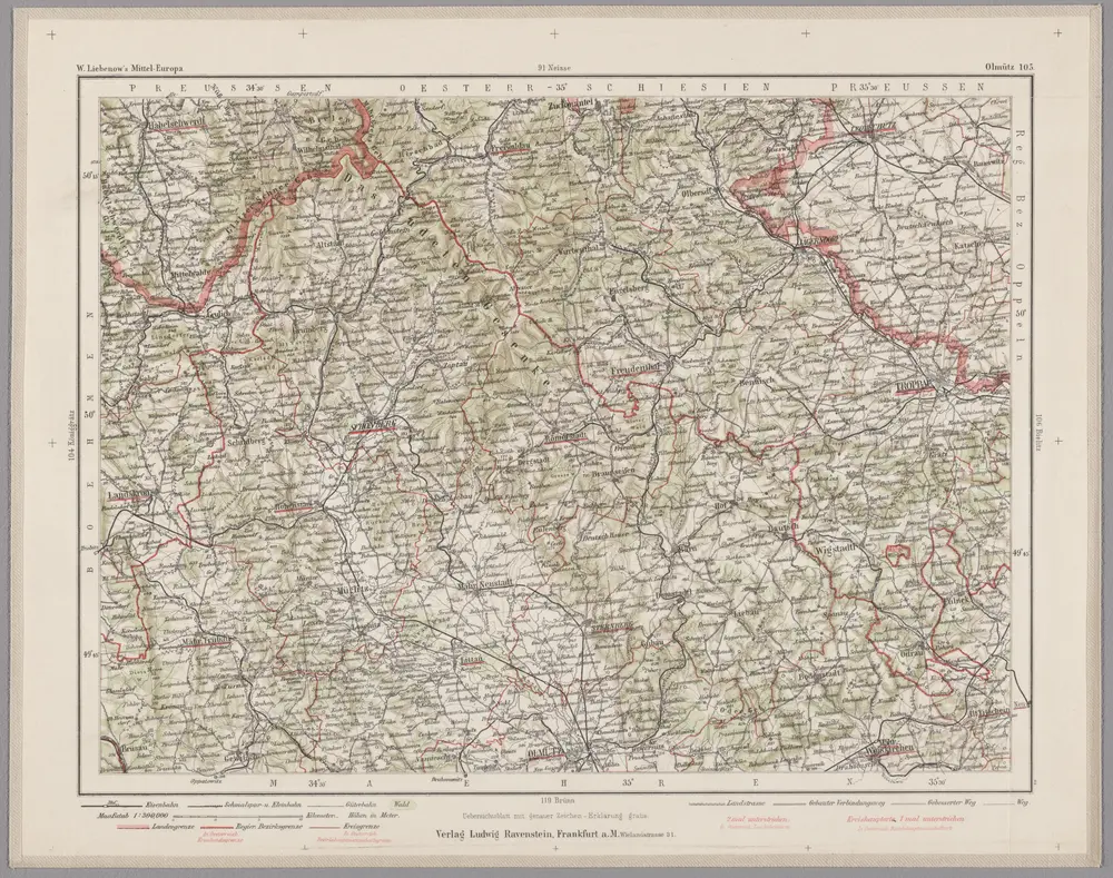
Olmütz 105, uit: Special-Karte von Mittel-Europa / nach amtlichen Quellen bearbeitet von W. Liebenow
1899
Johannes Wilhelm Liebenow 1822-1897
1:300k

Neuer Atlas Uber die Gantze Welt, mapa ze strany: [129]
1714
Homann Johann Baptist
n/a
1737

Atlas von den an Böhmen und Mähren gränzenden Fürstenthümern Schlesiens mit der Grafschaft Glatz, mapa ze strany: [11]
1796
Weiland I. W.
Moraviæ, qvae olim Marcomannorvm sedes, corographia
1579
Fabritius; Ortelius
Moraviæ, qvae olim Marcomannorvm sedes, corographia
1573
Fabritius; Ortelius
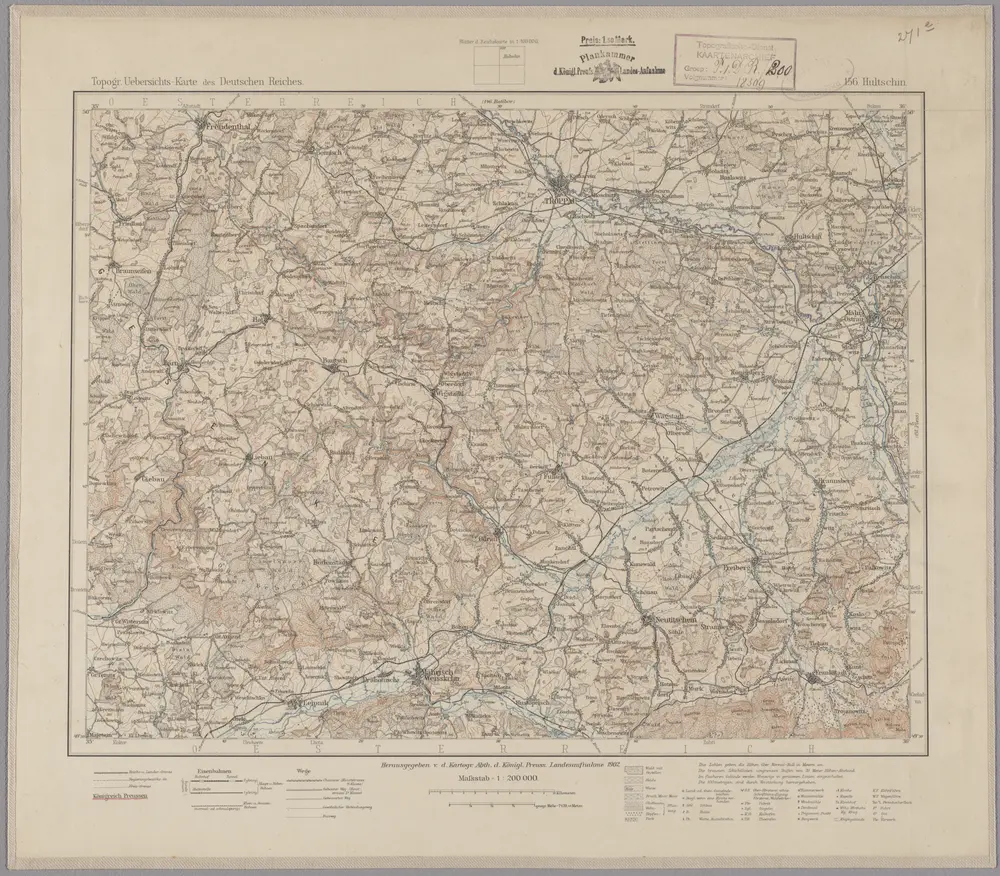
156. Hultschin, uit: Topographische Uebersichtskarte des Deutschen Reiches / herausgegeben v. d. Kartogr. Abt. d. Königl. Preuß. Landesaufnahme
1899
Königlich Preußische Landesaufnahme. Kartographische Abtheilung
1:200k

Neuer Atlas Uber die Gantze Welt, mapa ze strany: [135]
1714
Homann Johann Baptist