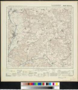
Maps of Landkreis Schwandorf

Meßtischblatt 6539 : Nabburg, 1937
1 : 250000 Nabburg. - Aufn. 1934, Ausg. 1937. - 1:25000. - München: Topograph. Zweigstelle d. Bayer. Landesvermessungsamts, 1937. - 1 Kt.
Mapa revíru Mendryka
1 : 11520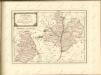
Müllerova mapa Čech
1 : 132000
exhibet Continuationem Partis Palatinatus Super: Regiminis Straubing: et Villam Jmperialem Augusta Tiberii
1 : 150000 Mollova mapová sbírka Buna, Wilhelm C. Broenner, Heinrich Ludwig
Pars II. exhibet continuationem partis palatinatus super: regiminis Straubing: et villam jmperialem Augusta Tiberii
1 Karte : 54 x 52 cm Heinrich Ludwig Broenner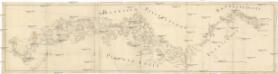
[Böhmerwald und die Umgebung von Eger]
1 : 80000 Cheb-oblast (Česko)
Sacri Romani imperii circuli et electoratus Bavariae tabula, 2
4 Blätter : s.n.
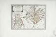
Mappa geographica regni Bohemiae in duodecim circulos divisae ...
[Nová Mapa království Českého]
1 : 200000 Šumava Kotyška, Václav Hanf, Norbert Bursík & Kohout
Nová Mapa království Českého
1 : 200000 Šumava Kotyška, Václav Hanf, Norbert Bursík & Kohout
Deutsche Strassenprofilkarte für Radfahrer
Furth im Wald (Německo) Mittelbach's Verlag

Taus 116, uit: Special-Karte von Mittel-Europa / nach amtlichen Quellen bearbeitet von W. Liebenow
1 : 300000 titelvariant: W. Liebenow's Mittel-Europa; Annotatie: Titel boven de bladen: W. Liebenow's Mittel-Europa Johannes Wilhelm Liebenow 1822-1897 Frankfurt a. M. : Ludwig Ravenstein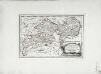
Des Herzogthums Oberpfalz nördliche Pfleggerichte mit der gefürsteten Grafschaft Sternstein
1 Karte : Kupferdruck ; 18 x 27 cm Reilly F. J. J. von Reilly

C. Flemming's Karte von Deutsch - Französischen Kriegsschaupltze
Das Fürstenthum Sulzbach und die Landgrafschaft Leuchtenberg
1 Karte : Kupferdruck ; 19 x 28 cm Reilly F. J. J. von Reilly
Sacri Imperii Romani Circuli et Electoratus Bavariae cum Finitimis Geographica Descriptio. Cum Privilegio D.D. Ordinum Generalium ut et Hollandiae West Frisiaequae]
1 : 270000 Mollova mapová sbírka Valck, Leonardus
Carte chorographique de la Boheme...

Carte topographique d'Allemagne contenant le Haut Palatinat, une partie du royaume de Boheme, de la Basse Baviere
1 Karte : Kupferdruck ; 46 x 61 cm Jaeger; Facius I. W. A. Iaeger ches qui cette carte se vend
Sacri Romani imperii circuli et electoratus Bavariae tabula, 1
4 Blätter : s.n.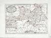
Des Herzogthums Oberpfalz südliche Pfleggerichte
1 Karte : Kupferdruck ; 24 x 35 cm Reilly F. J. J. von Reilly
Sacri imperii Romani circuli et electoratus Bavariæ, 2
1 Karte : mehrfarbig ; R. et J. Ottens
Palatinatvs Bavariæ
1 Karte : Kupferdruck ; 35 x 47 cm Valck; Schenk apud G. Valk et P. Schenk
Palatinatvs Bavariæ
1 Karte : Kupferdruck ; 36 x 48 cm Blaeu excudit Guiljelmus Blaeuw
Palatinatvs Bavariæ
1 Karte : Kupferdruck ; 35 x 48 cm Hondius; Mercator; Janssonius apud Ioannem Ianssonium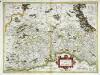
Palatinatvs Bavariae
1 Karte : Kupferdruck ; 35 x 48 cm Mercator; Hondius excusum apud Henricum Hondium sub insigno Atlantis
Palatinatvs Bavariae
1 Karte : Kupferdruck ; 35 x 48 cm Mercator s.n.