Maps of Samtgemeinde Wesendorf

Composite: 263. Wittingen.
1 : 100000 Reichsamt fur Landesaufnahme
Meßtischblatt 1820 : Gamsen, 1901
1 : 250000 Gamsen. - Aufn. 1899. - 1:25000. - [Berlin]: Reichsamt für Landesaufnahme, 1901. - 1 Kt.
Meßtischblatt 3428 : Müden, 1937
1 : 250000 Müden. - Hrsg. 1901, einz. Nachtr. 1932, gedr. [19]37. - 1:25000. - [Berlin]: Reichsamt für Landesaufnahme, 1937. - 1 Kt.
Meßtischblatt 1819 : Müden, 1901
1 : 250000 Müden. - Aufn. 1899. - 1:25000. - [Berlin]: Reichsamt für Landesaufnahme, 1901. - 1 Kt.
Meßtischblatt 1748 : Wahrenholz, 1932
1 : 250000 Wahrenholz. - Hrsg. 1901, einz. Nachtr. 1932. - 1:25000. - [Berlin]: Reichsamt für Landesaufnahme, 1932. - 1 Kt.
Meßtischblatt 1747 : Gr. Ösingen, 1901
1 : 250000 Gr. Ösingen. - Aufn. 1899, hrsg. 1901. - 1:25000. - [Berlin]: Reichsamt für Landesaufnahme, 1901. - 1 Kt.
Meßtischblatt 3430 : Ehra, 1938
1 : 250000 Ehra. - Hrsg. 1901, kl. Nachtr. 1924, gedr. [19]38. - 1:25000. - [Berlin]: Reichsamt für Landesaufnahme, 1938. - 1 Kt.
Meßtischblatt 1821 : Ehra, 1901
1 : 250000 Ehra. - Aufn. 1899. - 1:25000. - [Berlin]: Reichsamt für Landesaufnahme, 1901. - 1 Kt.
Meßtischblatt 1749 : Knesebeck, 1912
1 : 250000 Knesebeck. - Hrsg. 1901, [gedr. 19]12. - 1:25000. - [Berlin]: Reichsamt für Landesaufnahme, 1912. - 1 Kt.
263. Wittingen.
1 : 100000 Reichsamt fur Landesaufnahme
Meßtischblatt 1675 : Sprakensehl, 1932
1 : 250000 Sprakensehl. - Hrsg. 1901, einz. Nachtr. 1932. - 1:25000. - [Berlin]: Reichsamt für Landesaufnahme, 1932. - 1 Kt.
Meßtischblatt 1676 : Hankensbüttel, 1932
1 : 250000 Hankensbüttel. - Hrsg. 1901, einz. Nachtr. 1932. - 1:25000. - [Berlin]: Reichsamt für Landesaufnahme, 1932. - 1 Kt.
Meßtischblatt 3230 : Wittingen, 1939
1 : 250000 Wittingen. - Hrsg. 1901. - 1:25000. - [Berlin]: Reichsamt für Landesaufnahme, 1939. - 1 Kt.
Meßtischblatt 1818 : Bröckel, 1937
1 : 250000 Bröckel. - Hrsg. 1901, einz. Nachtr. 1931, gedr. [19]37. - 1:25000. - [Berlin]: Reichsamt für Landesaufnahme, 1937. - 1 Kt.
Meßtischblatt 1746 : Beedenbostel, 1901
1 : 250000 Beedenbostel. - Aufn. 1899. - 1:25000. - [Berlin]: Reichsamt für Landesaufnahme, 1901. - 1 Kt.

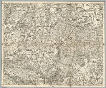
74. Salzwedel, uit: Topographische Uebersichtskarte des Deutschen Reiches / herausgegeben v. d. Kartogr. Abt. d. Königl. Preuß. Landesaufnahme
1 : 200000 titelvariant: Topogr. Übersichtskarte des Deutschen Reiches; Annotatie: Titel boven bladen ook: Topogr. Übersichtskarte des Deutschen Reiches; Annotatie geografische gegevens: Op elk blad twee maatstokken: 10 Kilometer = 5,5 cm; 1 geogr. Meile = 3,6 cm; Legenda onder op elk blad Königlich Preußische Landesaufnahme. Kartographische Abtheilung [S.l : Königlich Preußische Landesaufnahme, Kartographische Abtheilung]
Carte topographique d'Allemagne
1 : 214500 Braniborsko (Německo) Jaeger, Johann Wilhelm Abraham Berndt, Johann Christoph I.W.A. Iaeger
288. Braunschweig.
1 : 100000 Reichsamt fur Landesaufnahme
Composite: 262. Celle.
1 : 100000 Reichsamt fur Landesaufnahme
262. Celle.
1 : 100000 Reichsamt fur Landesaufnahme
Meßtischblatt 1674 : Eschede, 1937
1 : 250000 Eschede. - Hrsg. 1901, einz. Nachtr. 1937. - 1:25000. - [Berlin]: Reichsamt für Landesaufnahme, 1937. - 1 Kt.
Meßtischblatt 1674 : Eschede, 1901
1 : 250000 Eschede. - Aufn. 1899. - 1:25000. - [Berlin]: Reichsamt für Landesaufnahme, 1901. - 1 Kt.

Ducatus Luneburgicus cum comitatu Dannebergensi
1 : 336000 Lüneburg (Německo) Seutter, Matthäus Matth. Seutter

Ducatus Luneburgici et comitatus Dannenbergensis
1 : 363000 Lüneburg (Německo) Visscher, Nicolaus Schenk, Pieter Pet. Schenk Iun.
Ducatus Luneburgici et comitaus Dannebergensis accurata descriptio
1 : 380000 Dolní Sasko (Německo) Homann, Johann Baptist J. B. Homann
Ducatus Lunenburgensis in omnes ejusdem subjacentes praefecturas Nova descriptio
1 : 870000 Mollova mapová sbírka Danckerts, Justus Danckerts, Justus