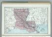
Maps of Louisiana
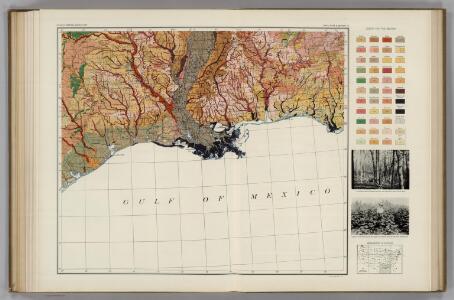
Soil Map of the United States, Section 10. Atlas of American Agriculture.
1 : 2500000 Marbut, Curtis F.
Map of Louisiana, Mississippi, and Arkansas.
from New general atlas.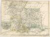
Die Staaten von Arkansas, Mississippi, Louisiana und Alabama
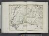
Luigiana Inglese, colla parte Occidentale, della Florida, della Georgia, e Carolina Merid[i]onale.
from Le colonie unite dell' America settentrle : di nuova projezione a s.s.e.e. li Signori Riformatori dello Studio di Padova.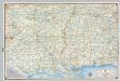
Shell Sectional Map No. 8 - Gulf States.
1 : 1710720 Shell Oil Company
Mississippi Territory.
from Carey's general atlas, improved and enlarged : being a collection of maps of the world and quarters, their principal empires, kingdoms, &c.
Louisiana, Mississippi, Alabama.
1 : 1808000 Finley, Anthony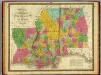
Map of Louisiana, Mississippi and Alabama.
1 : 1700000 Mitchell, Samuel Augustus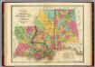
Map of Louisiana Mississippi And Alabama.
1 : 1750000 Finley, Anthony
Alabama, Arkansas, Louisiana, and Mississippi.
1 : 3000000 Lloyd, H.H.
Alabama, Arkansas, Louisiana, and Mississippi.
1 : 3000000 Walling, H. F.
Mississippi, Louisiana, and Arkansas.
1 : 3623775 Fisher, Richard Swainson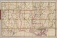
(Louisiana) Railroad Map of the United States.
1 : 506880 Rand McNally and Company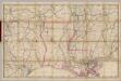
(Louisiana) Railroad Map of the United States.
1 : 506880 Rand McNally and Company
E. United States 9.
1 : 1774080 Letts, Son & Co.
Louisiana.
from Carey's general atlas, improved and enlarged : being a collection of maps of the world and quarters, their principal empires, kingdoms, &c.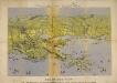
Panorama of the Seat of War. Bird's-eye View of Louisiana, Mississippi, Alabama and part of Florida. Drawn from nature by J. Bachmann.
Panorama of the Seat of War. Bird's-eye View of Louisiana, Mississippi, Alabama and part of Florida. Drawn from nature by J. Bachmann. This 1861 map presents a ‘Bird’s Eye View’ of the Gulf region around Louisiana, Mississippi, Alabama and the edge of Florida. Drawn and published by John Bachmann, the map details numerous strategic forts around this region, including Forts Pickens, Phillip and Jackson, as well as the city of New Orleans. The map highlights how important water routes and control of coastal defences were by both sides during the conflict.
Ala., Miss., La., Ark.
1 : 4700000 Grigg, John
Texas, Louisiana.
1 : 1584000 Smith, J. Calvin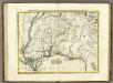
Luigiana Inglese, colla Parte Occidentale della Florida, della Giorgia, e Carolina Meridonale.
1 : 2100000 Zatta, Antonio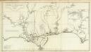
Carte de la Louisiane.
1 : 830000 Anville, Jean Baptiste Bourguignon d, 1697-1782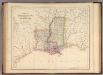
States Of Mississippi And Louisiana.
1 : 3453120 Rogers, Henry Darwin
Mississippi & Lousiana.
1 : 2150000 Black, Adam & Charles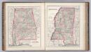
Alabama. Mississippi.
1 : 1533000 Colton, G. Woolworth
Louisiana and Mississippi.
1 : 1110000 Tanner, Henry S.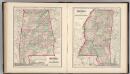
Alabama. Mississippi.
1 : 1533000 Gray, Ormando Willis
Louisiana and Mississippi.
1 : 1280000 Asher & Adams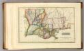
Louisiana.
1 : 1970000 Lucas, Fielding Jr.
Map of Louisiana, Mississippi. And Arkansas
1 : 3000000 Mitchell, Samuel Augustus Jr.