Maps of East Lothian
Berwick-shire.
1 : 90000 Thomson, John
Mercia vulgo vicecomitatvs Bervicensis
1 Karte : Kupferdruck ; 36 x 48 cm Pont; Blaeu Joan Blaeu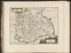
Mercia, vulgo vicecomitatus, Bervicensis / auct. Timothei Pont. Merce or Shirrefdome of Berwick.
Pont, Timothy, 1560?-1614? Blaeu, Joan 1596-1673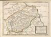
The Shire of Berwick alias the Mers or March and Lauderdale / by H. Moll.
Moll, Herman, d. 1732
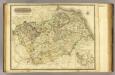
Map of the County of Berwick.
Armstrong, Andrew, 1700-1794 Armstrong, Mostyn, fl. 1769-1791
Map of the County of Berwick.
Armstrong, Andrew, 1700-1794 Armstrong, Mostyn, fl. 1769-1791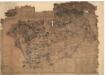
Berwickshire.
Blackadder, John, fl. 1793-1830
Map of the County of Berwick.
Armstrong, Andrew, 1700-1794 Armstrong, Mostyn, fl. 1769-1791
The County of Berwick.
Greenwood, Christopher, 1786-1855 Fowler, William, fl. 1818-1863 Sharp, T.
The County of Berwick.
Greenwood, Christopher, 1786-1855 Fowler, William, fl. 1818-1863 Sharp, T.
Map of the County of Berwick.
Armstrong, Andrew, 1700-1794 Armstrong, Mostyn, fl. 1769-1791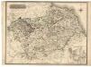
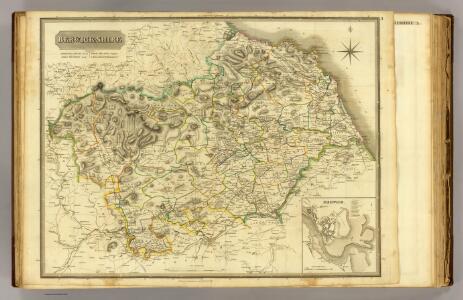
Berwick-Shire.
Thomson, John, 1777- ca. 1840 Johnson, William, fl. 1806-1840
Dunbar & Lammermuir (75) - OS One-Inch map
1 : 63360 Topographic maps Ordnance Survey Ordnance Survey
Dunbar & Lammermuir (75) - OS One-Inch map
1 : 63360 Topographic maps Ordnance Survey Ordnance Survey
Dunbar - OS One-Inch Map
1 : 63360 Topographic maps Ordnance Survey Ordnance Survey
Norham (Hills) - OS One-Inch Revised New Series
1 : 63360 Topographic maps Ordnance Survey Ordnance Survey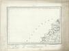
Norham (Outline) - OS One-Inch Revised New Series
1 : 63360 Topographic maps Ordnance Survey Ordnance Survey
NT66 - OS 1:25,000 Provisional Series Map
1 : 25000 Topographic maps Ordnance Survey Ordnance Survey
NT65 - OS 1:25,000 Provisional Series Map
1 : 25000 Topographic maps Ordnance Survey Ordnance Survey
NT64 - OS 1:25,000 Provisional Series Map
1 : 25000 Topographic maps Ordnance Survey Ordnance Survey
NT76 - OS 1:25,000 Provisional Series Map
1 : 25000 Topographic maps Ordnance Survey Ordnance Survey
NT75 - OS 1:25,000 Provisional Series Map
1 : 25000 Topographic maps Ordnance Survey Ordnance Survey
NT74 - OS 1:25,000 Provisional Series Map
1 : 25000 Topographic maps Ordnance Survey Ordnance Survey
NT86 & Parts of N87 - OS 1:25,000 Provisional Series Map
1 : 25000 Topographic maps Ordnance Survey Ordnance Survey
NT85 - OS 1:25,000 Provisional Series Map
1 : 25000 Topographic maps Ordnance Survey Ordnance Survey
NT84 - OS 1:25,000 Provisional Series Map
1 : 25000 Topographic maps Ordnance Survey Ordnance Survey
NT96 - OS 1:25,000 Provisional Series Map
1 : 25000 Topographic maps Ordnance Survey Ordnance Survey
NT95 & Parts of NU05 - OS 1:25,000 Provisional Series Map
1 : 25000 Topographic maps Ordnance Survey Ordnance Survey
NT94 - OS 1:25,000 Provisional Series Map
1 : 25000 Topographic maps Ordnance Survey Ordnance Survey