Maps of Great Britain

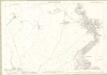
NT96 - OS 1:25,000 Provisional Series Map
1 : 25000 Topographic maps Ordnance Survey Ordnance Survey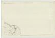
Berwickshire, Sheet VI - OS 6 Inch map
1 : 10560 Topographic maps Ordnance Survey Ordnance Survey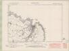
Berwickshire Sheet VI.SW - OS 6 Inch map
1 : 10560 Topographic maps Ordnance Survey Ordnance Survey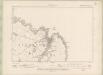
Berwickshire Sheet VI.SW - OS 6 Inch map
1 : 10560 Topographic maps Ordnance Survey Ordnance Survey
Berwickshire Sheet VI.SW - OS 6 Inch map
1 : 10560 Topographic maps Ordnance Survey Ordnance Survey
Berwickshire Sheet XII.NW - OS 6 Inch map
1 : 10560 Topographic maps Ordnance Survey Ordnance Survey
Berwickshire Sheet XII.NW - OS 6 Inch map
1 : 10560 Topographic maps Ordnance Survey Ordnance Survey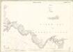
Berwickshire, Sheet 006.09 & 006.10 - 25 Inch Map
1 : 2500 Topographic maps Ordnance Survey Ordnance Survey
Berwick, Sheet VI.10 (Ayton) - OS 25 Inch map
1 : 2500 Topographic maps Ordnance Survey Ordnance Survey
Berwick, Sheet VI.9 (With inset VI.10 and VI.14) (Eyemouth) - OS 25 Inch map
1 : 2500 Topographic maps Ordnance Survey Ordnance Survey
Berwickshire, Sheet 006.09 & 006.10 - 25 Inch Map
1 : 2500 Topographic maps Ordnance Survey Ordnance Survey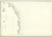
Berwick, Sheet VI.14 (Ayton) - OS 25 Inch map
1 : 2500 Topographic maps Ordnance Survey Ordnance Survey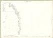
Berwickshire, Sheet 006.14 - 25 Inch Map
1 : 2500 Topographic maps Ordnance Survey Ordnance Survey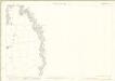
Berwickshire, Sheet 006.14 - 25 Inch Map
1 : 2500 Topographic maps Ordnance Survey Ordnance Survey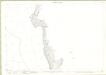
Berwickshire, Sheet 012.02 - 25 Inch Map
1 : 2500 Topographic maps Ordnance Survey Ordnance Survey
Berwickshire, Sheet 012.02 - 25 Inch Map
1 : 2500 Topographic maps Ordnance Survey Ordnance Survey
Berwick, Sheet XII.2 (Ayton) - OS 25 Inch map
1 : 2500 Topographic maps Ordnance Survey Ordnance Survey
Berwickshire, Sheet 006.13 - 25 Inch Map
1 : 2500 Topographic maps Ordnance Survey Ordnance Survey
Berwickshire, Sheet 006.13 - 25 Inch Map
1 : 2500 Topographic maps Ordnance Survey Ordnance Survey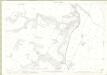
Berwickshire, Sheet 012.01 - 25 Inch Map
1 : 2500 Topographic maps Ordnance Survey Ordnance Survey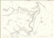
Berwickshire, Sheet 012.01 - 25 Inch Map
1 : 2500 Topographic maps Ordnance Survey Ordnance Survey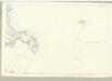
Berwick, Sheet VI.9 (with inset VI.13) (Coldingham) - OS 25 Inch map
1 : 2500 Topographic maps Ordnance Survey Ordnance Survey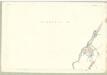
Berwick, Sheet VI.13 (Ayton) - OS 25 Inch map
1 : 2500 Topographic maps Ordnance Survey Ordnance Survey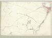
Berwick, Sheet VI.13 (Eyemouth) - OS 25 Inch map
1 : 2500 Topographic maps Ordnance Survey Ordnance Survey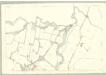
Berwick, Sheet XII.1 (Ayton) - OS 25 Inch map
1 : 2500 Topographic maps Ordnance Survey Ordnance Survey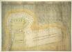
A Plan of Aymouth, or Eyemouth, [Berwickshire] taken in 1557, in which year it was fortified by Henri Clutin, Sieur d'Oysell et de Ville Parisis
This is a plan of Eyemouth in the south east of Scotland. Its strategic importance is notable due to its proximity to Berwick upon Tweed on the Anglo-Scottish border. The walled town of Eymouth (Aymouth) is shown by two long streets of generalised house structures. Entrance points in the walls are indicated. The fort is shown to the left of the town and is defended by cannons. In the 16th century the Scots were the recipients of military aid from their allies the French. During the regency of Mary of Guise the French provided the Scots with border defences against English invasion by the building of modern fortresses. A scale bar is included in this plan which dates the plan to 1557.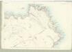
Berwick, Sheet V.4 (Coldingham) - OS 25 Inch map
1 : 2500 Topographic maps Ordnance Survey Ordnance Survey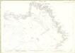
Berwickshire, Sheet 005.04 & 002.16 - 25 Inch Map
1 : 2500 Topographic maps Ordnance Survey Ordnance Survey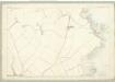
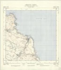
Berwick, Sheet V.8 (Coldingham) - OS 25 Inch map
1 : 2500 Topographic maps Ordnance Survey Ordnance Survey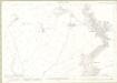
Berwickshire, Sheet 005.08 & 006.05 - 25 Inch Map
1 : 2500 Topographic maps Ordnance Survey Ordnance Survey