Maps of Balkan Pen.
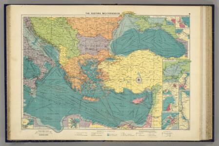
E. Mediterranean.
1 : 5000000 Philip, George
Countries Traveled by the Apostles. (1826)
1 : 9900000 Tanner, Henry S.
Levante Dienst
Středozemní moře-oblast východní
Orbis Romani pars orientalis, auspiciis serenissimi principis Ludovici Philippi Aurelianorum ducis publici juris facta
1 : 4300000
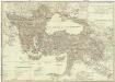
Europaeische und asiatische Türkey
1 : 3530000 Evropa jihovýchodní Mollo, Tranquillo T. Mollo
Nr. 15. Der russisch-türkische Krieg 1877/78
Balkanhalbinsel Russisch-Russisch-Türkischer Krieg <1877-1878>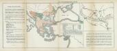
Nr. 11. Der russisch-türkische Krieg 1877/78
Balkanhalbinsel Russisch-Russisch-Türkischer Krieg <1877-1878>
Karte zur Geschichte der Kreuzzüge
1 : 6500000 Evropa jihovýchodní Cremersche Buchhandlung
L'Empire Grec en 1190 et l'Hellenisme pendant l'occupation latine de Constantinople [Hauptkarte]
Byzantinisches Reich Lateinisches Kaiserreich Konstantinopel Hellenismus Kümmerly & Frey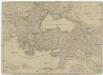
Europaeische und asiatische Türkey
1 : 7100000 Blízký východ Mollo, Tranquillo T. Mollo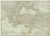
Europaeische und asiatische Türkey
1 : 7100000 Evropa jihovýchodní Mollo, Tranquillo Tranquillo Mollo
Süd-Europa & Vorder-Asien zur Zeit der Kreuzzüge
Südosteuropa, Byzantinisches Reich, Kreuzzüge
Die Türkey
Evropa jihovýchodní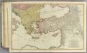
Mediterranean E.
1 : 2850000 Faden, William, 1750?-1836
Cesta Israelitů z Egypta a cesty sv. Pavla
Europaeische und asiatische Türkey
1 : 4300000 Blízký východ Mollo, Tranquillo T. Mollo
De landen van 't Romeinsche gebied in welke de Christen kerk, kort na Christus hemelvaard, door den dienst der apostelen is uitgebreid : tot verklaringe van de Handelingen der Apostelen
1 : 6500000 afgebeeld door W.A. Bachiene J. van Jagen mapp. sculpsit, et figur. apposit sculpturam curavit ; S. Fokke fecit. Uitgegeven te Gorinchem : by Nicolaas Goetzee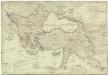
Europaeische und asiatische Türkey
1 : 4250000 Blízký východ Mollo, Tranquillo T. Mollo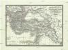
General Karte des Türkischen Reichs (in Europa und Asien)
1 : 6150000 Evropa jihovýchodní Artaria
General Karte des Türkischen Reichs (in Europa und Asien)
1 : 6150000 Asie západní Fried, Franz Artaria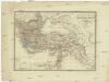
General Karte des Türkischen Reichs in Europa und Asien
1 : 6150000 Asie západní Fried, Franz Artaria
Schema glavnějšjch peredviženīj ėskadry admirala Ušakova i někotorych eja otděl'nych sudov v vojnu s Francīej 1798-1800 gg.
Mittelmeer Seeschlacht Ušakov, Fedor
Mare Mediterraneum, 2
1 Blatt : 47 x 58 cm G. und L. Valck
Peregrinationis divi Paulitypus Corographicus

Turkish Empire, Greece.
1 : 7200000 Society for the Diffusion of Useful Knowledge (Great Britain)
Uebersichts Karte des russisch - türkischen Kriegsschauplatzes in Europa und Asien

The Turkish empire in Europe and Asia with the Kingdom of Greece
1 : 8400000 Blízký východ Walker, C. Society for the diffusion of useful knowledge
Die Zeit der Kreuzzüge
Südeuropa, Mittelmeerraum, Kreuzzüge
Das Oströmische Reich zur Zeit Karls des Gr.
Byzantinisches Reich