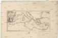
Maps of Mediterranean Sea

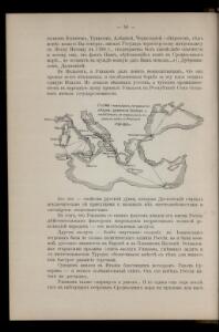
Schema glavnějšjch peredviženīj ėskadry admirala Ušakova i někotorych eja otděl'nych sudov v vojnu s Francīej 1798-1800 gg.
Mittelmeer Seeschlacht Ušakov, Fedor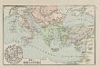
Die Kreuzzüge
Mittelmeerraum, Byzantinisches Reich, Kreuzzüge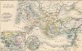
Die Zeit der Kreuzzüge
Südeuropa, Mittelmeerraum, Kreuzzüge
Generalkarte der Mittelmeerländer

Mittelländisches und Schwarzes Meer
Atlas der Hydrographie Berghaus, Hermann Justus Perthes
Karte zur Geschichte der Kreuzzüge
1 : 6500000 Evropa jihovýchodní Cremersche Buchhandlung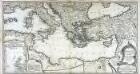
Theatre de la guerre entre les Russiens et les Turcs
1 Karte auf 2 Blatt : Kupferdruck ; 50 x 93 cm Roth C. M. Roth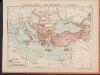
L'Empire Grec au Commencement du IX.e siècle
Byzantinisches Reich Kümmerly & Frey
Karte der griechischen Welt
Evropa jižní F. Tempsky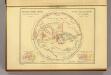
Geographie des Grecs Primitive.
Malte-Brun, Conrad, 1775-1826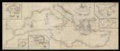
A correct chart of the Mediterranean sea from the coast of Portugal to the Levant
6 Carta nàutica. Conté: A plan of the city and Port of Civita-Vechia; The bay of Scanderoon; The bay of Tunis; A plan of the port of Neptune or Nation. Datació aproximada. Mount & Page William Mount & Thomas Page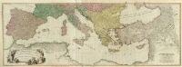
Composite: Mediterranean.
1 : 2850000 Faden, William, 1750?-1836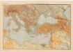
Východní Středomoří
Kuchař, Karel
Süd-Europa & Vorder-Asien zur Zeit der Kreuzzüge
Südosteuropa, Byzantinisches Reich, Kreuzzüge
Imperii Turcici Europaei Terra, in primis Graecia cum confiniis
1 : 4400000 Mollova mapová sbírka Harenberg, Johann Christoph Homann, Johann Baptista - dědici
M. Herberers ongelukkige voyagie gedaan in verscheyde gedeeltens van Asia en Africa
1 : 24000000 1 Karte : Kupferdruck ; 22 x 29 cm Aa, Pieter van der [Michel Herberer]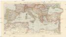
Karte der Länder des Mittelmeeres
1 : 5000000 Středozemní moře-oblast Freytag & Berndt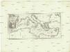
Karte des Mittellaendischen Meers
Středozemní moře Bonne, Rigobert Schraembl, Franz Anton F.A. Schraembl
IMPERII TVRCICI EVROPAEI TERRA, in primis GRAECIA
1 : 4700000 Turecko Harenberg, Johann Christoph curantibus Homannianis Heredibus
Imperii Tvrcici Evropaei terra, in primis Graecia cum confiniis, ad intelligendos scriptores N.T. ceterosque graecos et latinos accom[m]odata
1 : 4530000 Turecko Harenberg, Johann Christoph curantibus Homannianis Heredibus
Nova totius Graeciae, Italiae, Natoliae, Hungariae nec non Danubii fluminis cum adiacentib[us] regnis et provinc. tabula
1 : 7700000 Anatolie (Turecko) Sandrart, Johann Jakob von J. Sandrart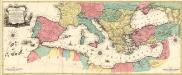
Carte Geographique representant la Mer Mediterranée ou la seconde Partie du Theatre de la Guerre entre les Russes et les Turcs
1 : 4400000 Mollova mapová sbírka Lotter, Tobias Conrad Lotter, Johann Jakob II.
Imperii Tvrcici Evropaei terra, in primis Graecia cum confiniis
1 : 4530000 Turecko Harenberg, Johann Christoph curantibus Homannianis Heredibus
Itinera expeditionum sacrarum
Europa, Mittelmeerraum, Reiseweg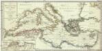
Karte des Mittellaendischen Meers enthaltend die europaische, afrikanische u. asiatische Küste
1 : 7000000 Středozemní moře-oblast Walch, Johann Joh. Walch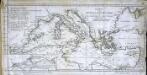
Charte vom mittellændischen Meer
1 Karte : Kupferdruck ; 23 x 49 cm Abel; Cotta im Verlag der J. G. Cotta'schen Buchhandlung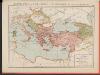
L'Empire Grec à la mort de Basile le Bulgarochtone et sous ses Héritiers
Byzantinisches Reich Basileios II.
Imperii Tvrcici Evropaei Terra, in primis Graecia cum confiniis
1 : 4400000 Mollova mapová sbírka Harenberg, Johann Christoph Homann, Johann Baptista - dědici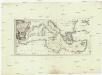
Karte des Mittellaendischen Meers
Středozemní moře-oblast Bonne, Rigobert Schraembl, Franz Anton F.A. Schraembl