Maps of Le Conquet
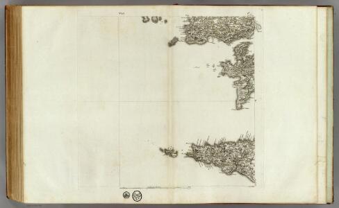
173 (175) Audierne, rade de Brest.
1 : 86400 Cassini family; Cassini, Cesar-Francois, 1714-1784
[Audierne - Rade de Brest]
1 Blatt : 62 x 63 cm s.n.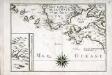
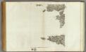
[Partie de la côte de la Bretagne]
1 Karte : 22 x 31 cm de Fer
Brest
1 Plan : Kupferdruck ; 20 x 28 cm Fer Nicolas de Fer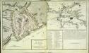
Plan de la ville de Brest
2 Karten auf 1 Blatt : Kupferdruck ; Bildgrösse 37 x 65 cm Bermont; Lattré chez Lattré graveur ordinaire du roi de Mr. le Duc d'Orléans et de la ville rue St. Jacques la porte cochère vis-à-vis la rue de la Parcheminerie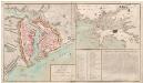
Plan de la Ville de Brest-Carte de la Rade et du Port de Brest
Plan de la Ville de Brest.-Carte de la Rade et du Port de Brest: par P.L. Bermont.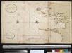
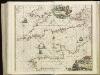
Nieuwe afteekening van de kust van Bretagne strekkende van Hijsand tot de Penmarkes inhoudende het Ras van Conquet en Fontenaij
France Johannes van Keulen
Composite 3: Carte de France.
1 : 86400 Cassini family; Cassini, Cesar-Francois, 1714-1784
A draught of the harbour of BREST and the Trade of ras fountaine shewing Islands, Sands, Rocks and Harbours, from port-sal and ushent to pennarks as it was surveyed by the order of the King of France at Brest
from The sea-atlas : containing an hydrographical description of most of the sea-coasts of the known parts of the world.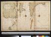
Nieuwe afteekening van de kust van Bretagne strekkende van Hijsand tot de Penmarkes inhoudende het Ras van Conquet en Fontenaij
France Johannes van Keulen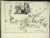
Carte de la rade et des environs de Brest
1 Karte : Kupferdruck ; 20 x 28 cm Fer Nicolas de Fer
Plan du port et de la rade de Brest
1 : 445000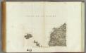
174 Quessant.
1 : 86400 Cassini family; Cassini, Cesar-Francois, 1714-1784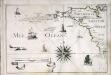
[Partie de la côte de la Bretagne]
1 Karte : 22 x 33 cm de Fer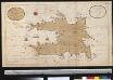
Het eijlant Heijsandt met alle desselfs geleegentheeden in t groot
France Gerard van Keulen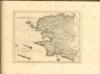

Carte de la France, no. 3
1 Blatt : 59 x 41 cm s.n.
7) IV.N.O. ''Morlaix'', uit: Carte géologique de France
1 : 500000 Annotatie: Voor aanwezige bladen zie bladoverzicht [S.l : s.n.]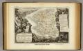
Dept. Du Finistere.
1 : 580000 Levasseur, Victor.
13) IV.S.O. ''Brest'', uit: Carte géologique de France
1 : 500000 Annotatie: Voor aanwezige bladen zie bladoverzicht [S.l : s.n.]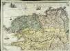
Carte géométrique de la province de Bretagne, 1
1 Blatt : chés l'auteur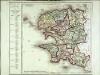
Département du Finisterre
1 Karte : Kupferdruck ; 48 x 48 cm Houdan au bureau de l'atlas national rue de la Harpe n.o 26, et au dépôt de cet atlas placé au cabinet bibliographique rue de la Monnoye n.o 5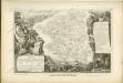

[Ouessant]
1 Blatt : 60 x 60 cm Aldring s.n.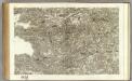
171 Carhaix, Brest.
1 : 86400 Cassini family; Cassini, Cesar-Francois, 1714-1784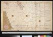
De dieptens en gronden voor het Kanaal
Ireland Gerard van Keulen
Carte de la République française, 1
1 Blatt : 42 x 51 cm P.G. Chanlaire
Carte du Canal ou de la Manche, 1
1 Blatt : 74 x 52 cm Esnauts et Rapilly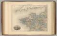
France N.O.
1 : 1615000 Migeon, J.