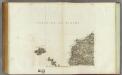
Maps of Plouarzel
174 Quessant.
1 : 86400 Cassini family; Cassini, Cesar-Francois, 1714-1784
[Ouessant]
1 Blatt : 60 x 60 cm Aldring s.n.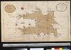
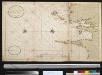
Het eijlant Heijsandt met alle desselfs geleegentheeden in t groot
France Gerard van Keulen
Composite 3: Carte de France.
1 : 86400 Cassini family; Cassini, Cesar-Francois, 1714-1784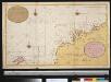
Een gedeelte van het Kanaal aen de kust van Vrankrijk van St. Garee tot aen Hijsand
France Gerard van Keulen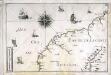
[Partie de la côte de la Bretagne]
1 Karte : 22 x 33 cm de Fer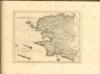
Nieuwe afteekening van de kust van Bretagne strekkende van Hijsand tot de Penmarkes inhoudende het Ras van Conquet en Fontenaij
France Johannes van Keulen
A draught of the harbour of BREST and the Trade of ras fountaine shewing Islands, Sands, Rocks and Harbours, from port-sal and ushent to pennarks as it was surveyed by the order of the King of France at Brest
from The sea-atlas : containing an hydrographical description of most of the sea-coasts of the known parts of the world.
Carte de la France, no. 3
1 Blatt : 59 x 41 cm s.n.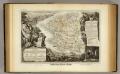
Dept. Du Finistere.
1 : 580000 Levasseur, Victor.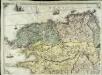
Carte géométrique de la province de Bretagne, 1
1 Blatt : chés l'auteur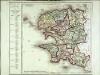
Département du Finisterre
1 Karte : Kupferdruck ; 48 x 48 cm Houdan au bureau de l'atlas national rue de la Harpe n.o 26, et au dépôt de cet atlas placé au cabinet bibliographique rue de la Monnoye n.o 5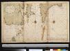
Nieuwe afteekening van de kust van Bretagne strekkende van Hijsand tot de Penmarkes inhoudende het Ras van Conquet en Fontenaij
France Johannes van Keulen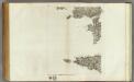
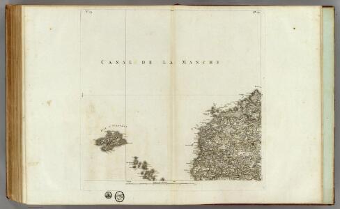
173 (175) Audierne, rade de Brest.
1 : 86400 Cassini family; Cassini, Cesar-Francois, 1714-1784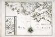
[Partie de la côte de la Bretagne]
1 Karte : 22 x 31 cm de Fer
Plan du port et de la rade de Brest
1 : 445000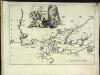
Carte de la rade et des environs de Brest
1 Karte : Kupferdruck ; 20 x 28 cm Fer Nicolas de Fer
[Audierne - Rade de Brest]
1 Blatt : 62 x 63 cm s.n.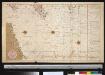
De dieptens en gronden voor het Kanaal
Ireland Gerard van Keulen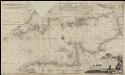
Nieuwe groote verbêterde en corekte gelijkgradige paskaart van het Canaal tusschen Engeland en Vrankerijk, als mede het verkeerde Canaal, met de droogtens, dieptens en de waatergetijden &a =
1 : 675000 naaukeurich opgestelt en in't ligt gebragt door [...] Chfel. Middagten Joan van Luchtenburch [...] delineavit et schulpcit [!] Amsterdam : bij J. Loots, boek en zeekaart verkooper in de Nieuwebrugsteeg in de Jonge Lootsman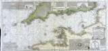
Carte de la Manche ou du Canal qui sépare les côtes de France d'avec celles d'Angleterre
1 Karte auf 2 Blättern : Kupferdruck ; 50 x 107 cm Beaurain; Martinet; Vallet chez le chevalier de Beaurain rue Git le cœur la 1.re porte à droite par le quay des Augustins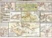
Tableau hidrographique qui contient le détail maritime des principaux ports qui se trouvent rèprèsentés dans la carte de la Manche
13 Karten auf einem Blatt : Kupferdruck ; Bildgrösse 47 x 70 cm Beaurain chez l'auteur rue Git-le Cœur la I.ere porte cochere à droite par le quai des Augustins
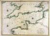
Der Kanal
1 : 400000 Lamanšský průliv Reichs-Marine-Amt
Carte des iles britanniques ou Royaume-Uni de la Grande Bretagne et d'Irlande, 5
2 Blätter : je 50 x 39 cm
Carte de la République française, 1
1 Blatt : 42 x 51 cm P.G. Chanlaire
Carte du Canal ou de la Manche, 1
1 Blatt : 74 x 52 cm Esnauts et Rapilly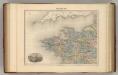
France N.O.
1 : 1615000 Migeon, J.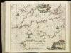
[130][133] Pascaert van 't Canaal tusschen Engeland en Vranckryck, uit: Atlas sive Descriptio terrarum orbis
Annotatie: Gedigitaliseerde versie. Amsterdam. Heiloo : Picturae (vervaardiger), 2015. tiff-bestand. Gedigitaliseerd: 07-01-2015; Origineel: Universiteitsbibliotheek Vrije Universiteit (XL.05127.-) ; Netherlands; Titelpagina ontbreekt Wit, Frederik de Amsterdam : Frederick de Wit