Maps of Central Lowland
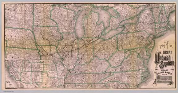
Great Wabash System.
1 : 3186000 Wabash, St. Louis, and Pacific Railway Company
Michigan Central Railroad.
1 : 6251500 Michigan Central Railroad Company
United States of America.
1 : 11960000 Tanner, Henry S.
A Connected View of The Whole Internal Navigation of the United States.
1 : 6082560 Tanner, Henry S.
Map of the United States
Lloyd, J. T.
Pennsylvania RR Great Trunk Line.
1 : 4055000 Rand McNally and Company
Map of the United States of America.
1 : 4942080 Maclure, William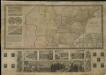
Phelps & Ensign's travellers' guide, and map of the United States, containing the roads, distances, steam boat and canal routes &c.

United States of America
1 : 2025000
Composite: Railroad Map of the United States.
1 : 506880 Rand McNally and Company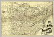
N.Y., Penn. and Ohio R.R.
1 : 6820000 New York, Pennsylvania and Ohio Railroad Company
Colton's new railroad & county map of the United States, the Canadas &c.

Map of the United States.
1 : 2407680 Robinson, Lewis
Die Vereinigten Staaten von Nordamerika
1 : 4100000 Severní Amerika Sotzmann, Daniel Friedrich Arrowsmith, Aaron in der Schneider- und Weigelschen k. k. privilegirten Kunsthandlung
Colton's New Railroad & County Map Of The United States.
1 : 3041280 Colton, J. H.
Composite: Colton's New Railroad & County Map Of The United States.
1 : 3041280 Colton, J. H.
Lines And Metallic Circuit Connections.
1 : 2155000 American Telephone and Telegraph Company
G. Woolworth Colton's new guide map of the United States & Canada : with railroads, counties etc.
1 : 3168000
United States of America.
1 : 1960000 Tanner, Henry S.
United States of America.
1 : 1960000 Tanner, Henry S.
Union Military Chart.
Magnus, Charles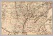
Chesapeake & Ohio Ry.
1 : 6523300 Chesapeake and Ohio Railway Company
Lay's map of the United States / compiled from the latest and best authorities and actual surveys by Amos Lay, geographer and map publisher ; engraved by O.H. & D.S. Throop & Wm. Chapin.
from Whole
United States of America.
1 : 1960000 Tanner, Henry S.
United States of America.
1 : 7603200 Melish, John
General-Karte der Vereinigten Staaten von Nord Amerika, nebst den grösst. Theilen von Canada & Tejas : mit Bezeichnung sämmtlicher Cantons, deren Haupt-u. Handelstädte, Eisenbahnen, Kunst- & Hauptstrassen, Canäle etc. etc.
1 : 3200000 nach den neuesten und besten New-Yorker Karten von J. Calvin Smith und H.S. Tanner, sowie nach Berghaus, Länder-& Völkerkunde entw. u. gez. von Albrecht Platt in Stein gest. u. gedr. im geogr. Institut von Albr. Platt ; in Stein gestochen v. Bomsdorf Magdeburg : Kaegelmann
United States.
1 : 8363520 Burr, David H., 1803-1875
United States / by David H. Burr, New-York.
from Whole David H. Burr,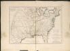
Carte de la Louisiane cours du Mississipi et pais voisins
1 : 6000000