Maps of Appalachian Mountains
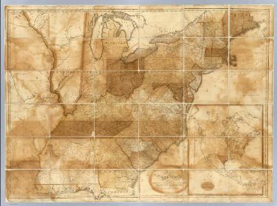
Map of the United States.
1 : 1900000 Bradley, Abraham Junior
United States.
1 : 8000000 Seaman, James V.
Mitchell's National Map of the United States.
1 : 3360000 Mitchell, Samuel Augustus
United States of America.
1 : 5630000 Carey, Mathew
Map of the United States of America.
1 : 6019200 Maclure, William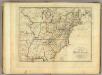
Map of the United States of America.
1 : 6000000 Carey, Mathew
Map of the United States of America.
1 : 6019200 Melish, John
Reference & Distance Map Of The United States.
1 : 1584000 Young, James H.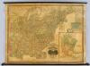
United States.
1 : 1964160 Woodbridge, J.L.
Mitchell's Reference & Distance Map of the United States.
1 : 1584000 Young, James H.
Mitchell's Reference & Distance Map Of The United States.
1 : 1584000 Young, James H.
Mitchell's Travellers Guide Through The United States.
1 : 14878700 Young, James H.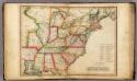
United States.
1 : 7603200 Melish, John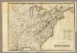
United States.
1 : 7603200 Melish, John
Map of the United States.
1 : 1900800 Varle, Charles P.
Mitchell's Reference & Distance Map Of The United States.
1 : 1584000 Young, James H.
Chapin's Ornamental Map Of The United States.
1 : 2150000 Chapin, William
Map of the United States of America / Gridley, sc.
from Whole Gridley,
Map of the United States of America / J. Melish, del.; H.S. Tanner, sc.
from Whole John Melish; Henry S. Tanner,
United States.
from Whole s.n.: [London?],
Mitchell's Reference & Distance Map Of The United States.
1 : 1584000 Young, James H.
United States of America / drawn & engraved for Wardens Statistical account by W. & D. Lizars, Edinburgh
1 : 6000000 Annotatie: Uit: A statistical, political, and historical account of the United States of North America ... / D.B. Warden. - Edinburgh : Constable, 1819 William Lizars; Daniel Lizars [Edinburgh : A. Constable & Co.]
A Map Of The Roads, Canals And Steam Boat Routes Of The United States
1 : 4118400 Tanner, Henry S.
United States of Nth. America = Carte des Etats-unis de l'Amérique septentrionale / copiée et gravée sur celle d'Arrowsmith; corrigée et considérablement augmentée d'après les renseignemens les plus authentiques par P.F. Tardieu, graveur, editeur-propriétaire, Place de l'Estrapade, No. 18. à Paris, an XL 1802; ecrit par J.J. Pachoux; Chles. Picquet, géographe-graveur ...
from Parts P.F. Tardieu; J. J. Pachoux; Charles Picquet,
Map of the roads, canals and steam boat routes of the United States: with the distances from place to place carefully noticed ... / designed for the use of travellers by H.S. Tanner.
from Whole Henry S. Tanner,
Map of the United States.
1 : 1950000 Bradley, Abraham Junior
United States of America.
1 : 5300000 Scott, Bradford
Map of the United States of America.
1 : 5800000 Melish, John
Map of the United States and British Provinces of Upper and Lower Canada.
1 : 1838000 Shelton, W.