Maps of Appalachian Mountains

Commercial Map, East of Chicago.
1 : 3950000 Rand McNally and Company
(United States) East of Chicago.
1 : 3802000 Rand McNally and Company
Spojené státy severoamerické III. Východní část

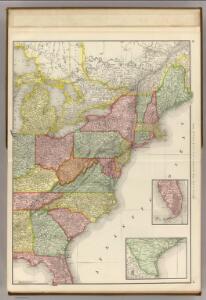
United States - eastern section.
1 : 5000000 John Bartholomew & Co.
Eastern United States.
1 : 4748000 Johnston, Alexander Keith
United States of America - East. Pergamon World Atlas.
1 : 5000000 Polish Army Topography Service
United States.
1 : 11200000 Worcester, Joseph E.
US Population 1830, 1840.
1 : 10040000 Walker, Francis Amasa, 1840-1897
United States.
1 : 8000000 Tanner, Henry S.
United States.
1 : 8000000 Tanner, Henry S.
Alden's Pictorial Map Of The United States Of North America.
1 : 2851200 Alden, Albert
United States.
1 : 11400000 Tanner, Henry S.
United States.
1 : 6200000 Hughes, William
United States.
1 : 8000000 Mitchell, Samuel Augustus
United States.
1 : 5068800 Arrowsmith, John
United States.
1 : 11400000 Finley, Anthony
United States.
1 : 5000000 Arrowsmith, John
Population - United States census, 1870. Density, Foreign, Colored, British American, Swedish and Norwegian.
1 : 15000000 Baskin, Forster and Company
Population - United States census, 1870. Density, Foreign, Colored, British American, Swedish and Norwegian.
1 : 14000000 Andreas, A. T. (Alfred Theodore), 1839-1900
Population, United States Census, 1870: Density, foreign, colored, British American, Swedish and Norwegian.
Andreas, A. T. (Alfred Theodore), 1839-1900
3. Population 1800.
1 : 16500000 Gannett, Henry, 1846-1914; United States. Census Office
7. Population 1840.
1 : 16500000 Gannett, Henry, 1846-1914; United States. Census Office
4. Population 1810.
1 : 16500000 Gannett, Henry, 1846-1914; United States. Census Office
8. Population 1850.
1 : 16500000 Gannett, Henry, 1846-1914; United States. Census Office
9. Population 1860.
1 : 16500000 Gannett, Henry, 1846-1914; United States. Census Office
5. Population 1820.
1 : 16500000 Gannett, Henry, 1846-1914; United States. Census Office
6. Population 1830.
1 : 16500000 Gannett, Henry, 1846-1914; United States. Census Office
2. Population 1790.
1 : 16500000 Gannett, Henry, 1846-1914; United States. Census Office
An accurate map of the United States of America: according to the Treaty of Peace of 1783.
from Whole Published as the Act directs by H.D. (Henry Delahoy) Symonds: London; Russell, John,