Maps of Bavaria
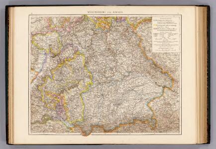
Wurttemberg, Bayern.
1 : 1000000 Andree, Richard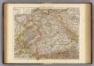
Wurtemberg, Bavaria.
1 : 1000000 Andree, Richard; Times (London, England)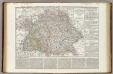
Regni di Baviera, Wurttemberg, Baden, Principati Prussiani.
1 : 2200000 Wieland, C. F.
Postkarte von Bayern, Würtemberg und Baden nebst Theilen der angrenzenden Laender
Bavorsko (Německo) Loehle, Franz Franz Loehle
La Baviere, le Wurtemberg, et le Gr. Duche de Bade
1 : 2000000 Malte-Brun, Conrad, 1775-1826
Chur-Bayern im Jahr 1804
1 : 1083000 Bavorsko (Německo) Herdegen, J. C. F. Leizel, Balthasar Friedrich J.L.C. Rheinwald
Germany S. of Mayne.
1 : 860000 Thomson, John
Germany No. 3.
1 : 1457280 Colton, G.W.
Chur-Bayern im Jahr 1802
1 Karte : Kupferdruck ; 39 x 43 cm Rheinwald; Herdegen; Leizel s.n.
Bayern.
1 : 850000 Weiland, C. F. (Carl Ferdinand), d. 1847
Bayern, Wurtemberg, Baden, Hohenzollern.
1 : 1800000 Reichard, C. G.

Königreich Bayern Bezirksämter 1862
Bayern Bezirksamt Kunz, Andreas ; Johnen, Bettina ; Moeschl, Joachim
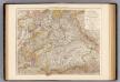
Bayern.
1 : 1390000 Flemming, Carl
Königreich Bayern Kreisunmittelbare Städte 1862
Bayern Kreisfreie Stadt Kunz, Andreas ; Johnen, Bettina ; Moeschl, Joachim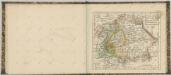
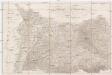
Kriegs Schauplatz vom Jahr 1796 in Deutschland
1 : 860000 Německo jižní Roßenberg Reiller, Fr.
Germany.
1 : 1500000 Colton, G.W.
Germany Southern.
1 : 1000000 Hall, S. (Sidney)
[Koenigreich Baiern, Würtemberg u. Baden]
Neuester Schul-Atlas Walch, Johann im Verlag bei Joh. Walch
Neueste Karte von Bayern Würtemberg, Baden und Hohenzollern
Grosser Hand-Atlas über alle Theile der Erde in 170 Karten Meyer, J. Verlag des Bibliographischen Instituts

Das Königreich Bayern
1 : 860000 Bavorsko (Německo) Weiland, Karl Ferdinand Gräf, A. Geographisches Institut
Das Konigreich Bayern
1 : 850000 Weiland, C.F.
Suevia Et Bavaria XI. Nova Tabula. [Karte], in: Geographia universalis vetus et nova complectens Claudii Ptolemaei Alexandrini enarrationis libros VIII, S. 329.
1 Karte aus Atlas Münster, Sebastian [und Ptolemaeus, Claudius]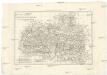
Les cercles de Souabe et de Baviere
1 : 1740000 Bavorsko (Německo) Bonne, Rigobert André
Baiern, Wurtemberg, Baden u. Hohenzollern.
1 : 980000 Streit, F. W.
Germany.
1 : 1500000 Colton, G.W.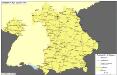
Straßen im Königreich Bayern 1848
Bayern Straßennetz Kunz, Andreas ; Treiling, Thomas