Maps of Bavaria


Neueste Karte von Bayern Würtemberg, Baden und Hohenzollern
Grosser Hand-Atlas über alle Theile der Erde in 170 Karten Meyer, J. Verlag des Bibliographischen Instituts
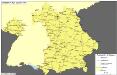
Königreich Bayern Kreisunmittelbare Städte 1862
Bayern Kreisfreie Stadt Kunz, Andreas ; Johnen, Bettina ; Moeschl, Joachim
Das Konigreich Bayern
1 : 850000 Weiland, C.F.
Königreich Bayern Bezirksämter 1862
Bayern Bezirksamt Kunz, Andreas ; Johnen, Bettina ; Moeschl, Joachim
[Koenigreich Baiern, Würtemberg u. Baden]
Neuester Schul-Atlas Walch, Johann im Verlag bei Joh. Walch
Southern Germany.
1 : 1710720 Fullarton, A. & Co.
SW Deutschland.
1 : 4100000 Brudin, J. L.; Stieler, Adolf
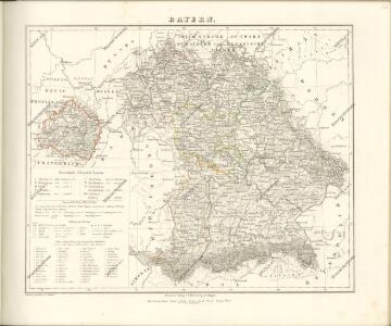
Bayern.
1 : 1390000 Flemming, Carl
Germany.
1 : 1500000 Colton, G.W.
Baden, Würtemberg, Baiern
Schul-Atlas in 36 Karten Völter, Daniel Verlag der J.M. Dannheimer'schen Buchhandlung
Germany.
1 : 1500000 Colton, G.W.
Bayern.
1 : 850000 Weiland, C. F. (Carl Ferdinand), d. 1847
Straßen im Königreich Bayern 1848
Bayern Straßennetz Kunz, Andreas ; Treiling, Thomas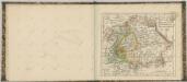

Post- und Reise- Karte vom Bayern und den angrenzenden Ländern und Ländertheilen mit besonderer Bezugnahme auf die schon bestehenden und projektirten Eisenbahnen ausgedehnt bis Basel, Düsseldorf, Dresden, Prag, Linz, Gastein, Insbruck und Bodensee, mit Entfernungs-Angabe der Poststationen
1 : 1100000 Bavorsko (Německo) Obernetter, Johann Baptist Verlag von Mey & Widmayer
Südwestliches Deutschland
Neuer Handatlas über alle Theile der Erde Kiepert, Heinrich Verlag von Dietrich Reimer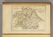
La Baviere, le Wurtemberg, et le Gr. Duche de Bade
1 : 2000000 Malte-Brun, Conrad, 1775-1826
Germany No. 3.
1 : 1457280 Colton, G.W.
Haupt-Dreiecknetz für das Königreich Bayern
1 : 1000000 Stiglmayer Contur Obernetter Schrift [gravirt] [S.l.] : [s.n.]
Süddeutschland
Volksschul-Atlas über alle Teile der Erde Lange, Henry Druck und Verlag von Georg Westermann
Het oorlogstooneel van 1796 in Duitschland
1 : 1850000 Annotatie: Kaart IV in: Prins Frederik der Nederlanden en zijn tijd / F. de Bas. - Dl. 1; Annotatie geografische gegevens: Inzetkrt: Het slagveld van Würzburg op 3 september. - 1:740.000 Schiedam : H.A.M. Roelants
Germany.
1 : 1500000 Colton, G.W.
Süddeutschland

Germany Southern.
1 : 1000000 Hall, S. (Sidney)
Bayern, Wurtemberg, Baden, Hohenzollern.
1 : 1800000 Reichard, C. G.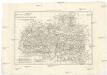
Les cercles de Souabe et de Baviere
1 : 1740000 Bavorsko (Německo) Bonne, Rigobert André
Allemagne du Sud.
1 : 1550000 Migeon, J.