Maps of Appalachian Mountains

United States E.
1 : 4748000 Johnston, Alexander Keith, 1804-1871
Eastern United States.
1 : 4748000 Johnston, Alexander Keith
United States.
1 : 5000000 Arrowsmith, John
United States of America - East. Pergamon World Atlas.
1 : 5000000 Polish Army Topography Service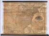
Mitchell's Reference & Distance Map Of The United States.
1 : 1584000 Young, James H.
Chapin's Ornamental Map Of The United States.
1 : 2217600 Taylor, J.B.
Map of the Atlantic States, Showing Distances From Washington (In BeeLine) By 50 Mile Circles.
1 : 8236800 Prang, L. & Co.
United States Of North America.
1 : 1550000 Arrowsmith, Aaron
Eastern United States.
1 : 4748000 Johnston, Alexander Keith
Map Of The United States.
1 : 11000000 Barber, John Warner
United States.
1 : 1500000 Smith, J. Calvin
Map of the United States Of North America.
1 : 1837440 Burr, David H., 1803-1875
New Map of the United States.
1 : 1584000 Young, James H.
United States.
1 : 8050000 Tanner, Henry S.
United States.
1 : 11400000 Tanner, Henry S.
United States.
1 : 6200000 Hughes, William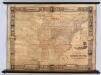
United States.
1 : 2471040 Munson, S. Bishop
United States.
1 : 11400000 Finley, Anthony
Alden's Pictorial Map Of The United States Of North America.
1 : 2851200 Alden, Albert
US Population 1830, 1840.
1 : 10040000 Walker, Francis Amasa, 1840-1897
United States.
1 : 8000000 Tanner, Henry S.
United States.
1 : 8000000 Tanner, Henry S.
United States.
1 : 10140000 Finley, Anthony
Population - United States census, 1870. Density, Foreign, Colored, British American, Swedish and Norwegian.
1 : 15000000 Baskin, Forster and Company
Population - United States census, 1870. Density, Foreign, Colored, British American, Swedish and Norwegian.
1 : 14000000 Andreas, A. T. (Alfred Theodore), 1839-1900
Population, United States Census, 1870: Density, foreign, colored, British American, Swedish and Norwegian.
Andreas, A. T. (Alfred Theodore), 1839-1900
United States.
1 : 11200000 Worcester, Joseph E.
Mitchell's Reference & Distance Map Of The United States.
1 : 1584000 Young, James H.
United States.
1 : 8000000 Mitchell, Samuel Augustus


