Maps of Poland

Prussia And Saxony.
1 : 2661120 Colton, G.W.
Prussian Dominions.
1 : 8500000 Fenner, Rest.
Preussen, Neuchatel, Valengin.
1 : 3200000 Radefeld, Carl Christian Franz, 1788-1874
Prussia.
1 : 4118400 Lucas, Fielding Jr.
Prussia.
1 : 3300000 Tanner, Henry S.
Prussia.
1 : 3300000 Tanner, Henry S.
Prussia.
1 : 4118400 Tallis, J. & F.
Prussia.
1 : 3200000 Mitchell, Samuel Augustus
Prussian States.
1 : 3738240 Burr, David H., 1803-1875
Carte de la monarchie prussienne, a l'orient du Weser
1 : 2300000 Prusko Mentelle, Edme Tardieu, Pierre François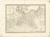

[Nordöstliches Deutschland]
Schul-Atlas über alle Theile der Erde nach dem neuesten Zustande, und über das Weltgebäude Stieler, Adolf Justus Perthes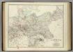
Empire of Germany (northern portion).
1 : 2032000 Johnston, Alexander Keith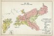
IX. 1815 - 1861. Preußen nach dem Wiener Kongreß
Preußen Wiener Kongress (1814-1815 : Wien)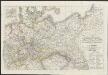
[Neuer Atlas der ganzen Erde nach den neuesten Bestimmungen ... : XVI.] Charte von Preussischen Staate, Gebirgs- und Fluss-Charte des nördlichen Teutschlands
Neu entworfen und gezeichnet von F.W. Streit gest. v. H. Leutemann Leipzig : J.C. Hinrichssche Buchhandlung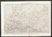
Nord-Deutschland
Geographischer Atlas über alle Theile der Erde Ziegler, Jakob Melchior Verlag von Joh. Wurster um Comp.
Prussia.
1 : 3300000 Tanner, Henry S.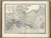
Preussische Staate.
1 : 1800000 Weiland, C. F. (Carl Ferdinand), d. 1847
General-Karte von dem Preussischen Staate
1 : 1850000 Neuchâtel-oblast (Švýcarsko) Weiland, Karl Ferdinand im Verlage des geograph. Instituts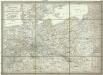
General-Karte von dem Preussischen Staate
1 : 1850000 Neuchâtel (Švýcarsko) Weiland, Karl Ferdinand im Verlage des geograph. Instituts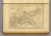
Prusse.
1 : 4100000 Malte-Brun, Conrad, 1775-1826
Prussia.
1 : 3200000 Tanner, Henry S.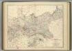
Empire of Germany (northern portion).
1 : 2032000 Johnston, Alexander Keith
Germany, Prussia and Saxony.
1 : 2500000 Colton, G.W.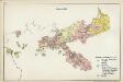
VI. 1740 - 1786
Preußen
Die Preussische Monarchie
Preußen
Prussia and Saxony.
1 : 3000000 Colton, G.W.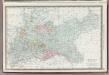
Germany Northern Portion.
1 : 2500000 Rand McNally and Company
Prussia.
1 : 1628000 Johnson, A.J.


