Maps of Poland

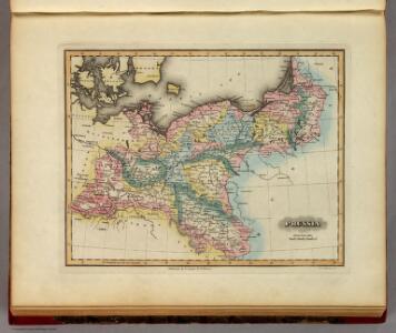
Prussia.
1 : 4118400 Lucas, Fielding Jr.
Carte de la monarchie prussienne, a l'orient du Weser
1 : 2300000 Prusko Mentelle, Edme Tardieu, Pierre François
Prussia And Saxony.
1 : 2661120 Colton, G.W.
Prussian States.
1 : 3738240 Burr, David H., 1803-1875
Germany, Prussia and Saxony.
1 : 2500000 Colton, G.W.
[Nordöstliches Deutschland]
Schul-Atlas über alle Theile der Erde nach dem neuesten Zustande, und über das Weltgebäude Stieler, Adolf Justus Perthes
Generale-Charte der Preussischen Monarchie in zwey Blättern
1 : 1030000 Prusko Streit, Friedrich Wilhelm Gilly Geograph. Institut
Prussia and Saxony.
1 : 3000000 Colton, G.W.
General-Karte von dem Preussischen Staate
1 : 1850000 Neuchâtel-oblast (Švýcarsko) Weiland, Karl Ferdinand im Verlage des geograph. Instituts
General-Karte von dem Preussischen Staate
1 : 1850000 Neuchâtel (Švýcarsko) Weiland, Karl Ferdinand im Verlage des geograph. Instituts
Prussian States.
1 : 5200000 Arrowsmith, Aaron; Lewis, Samuel
Prussia.
1 : 3400000 Finley, Anthony
Charte des nordöstlichen Deutschlands nebst Preussen u. Polen
Preußen, Kongresspolen
VII. 1786 - 1806
Preußen
III. 1608 - 1619
Brandenburg Expansion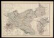
Prussia and Mecklenburg / drawn & engraved by J.W. Lowry
Lowry, Joseph Wilson Day & Son
Prussia and Saxony.
1 : 3000000 Colton, G.W.
Prussia.
1 : 3300000 Tanner, Henry S.
Prussia.
1 : 3300000 Tanner, Henry S.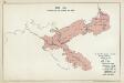
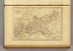
VIII. 1807 - 1815. Preußen nach dem Frieden von Tilsit
Preußen Tilsit / Friede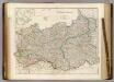
Prussia & Poland.
1 : 1584000 Arrowsmith, John
Prussia.
1 : 3300000 Tanner, Henry S.
Prusse.
1 : 4100000 Malte-Brun, Conrad, 1775-1826
Prussian States.
1 : 3900000 Greenleaf, Jeremiah
Prussian States.
1 : 3900000 Greenleaf, Jeremiah
Empire of Germany (northern portion).
1 : 2032000 Johnston, W. & A.K.
Karte der sämtlichen Preussischen Staaten
1 : 2500000 Prusko Mollo, Tranquillo bey T. Mollo
Carte Generale du Royaume de Prusse.
1 : 3000000 Vivien de St Martin, L.