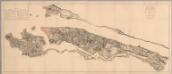
Maps of North Bergen
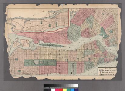
Plates 11 & 12: Map of New York City and central portion of Brooklyn.
from County atlas of Westchester, New York. Published by J.B. Beers & Co., assisted by S.W. Wilson and others.
Plan of New York and Brooklyn.
Beers, Frederick W.
Map of the city and county of New York, showing routes and stations of the elevated railroads.
From Manhattan
Topographical map of New York City, County and vicinity : showing old farm lines &c. / based on Randells and other official surveys, drawings and modern surveys by J.F. Harrison & T. Magrane ; printed by C. Wadlow.
from (A-Z)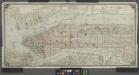
[Map of Manhattan from the Battery to 145th Street, showing adjacent portions of the Bronx, Long Island, and New Jersey]
from Manhattan
Map of New York City south of 118th street.
From Manhattan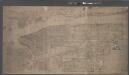
Topographical map of New York City, County and vicinity, showing old farm lines, etc. Based on Radell's and other official surveys, drawings and modern surveys.
From Manhattan
New York City
from New topographical atlas and gazetteer of New York, comprising a topographical view of the several counties of the state, ... including ... map of the United States and territories ... Compiled from the latest astronomical observations, official surveys and records of the United States and territories ...
Map of part of New York City, showing underground mains of the Edison Electric Illuminating Co. of New York.
From Manhattan
Heart of New York.
1 : 29800 New York Central Railroad Company
Plate 6: Plan of New York and Brooklyn.
from Atlas of New York and vicinity : from actual surveys / by and under the direction of F. W. Beers, assisted by A. B. Prindle & others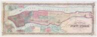
Colton's city & county map of New-York
1 : 20000 G.W. & C.B. Colton & Co G.W. and C.B. Colton
TheHeart of New York: Grand Central Terminal: Only Railway Station on the Subway, Elevated, and Surface Lines.
From Manhattan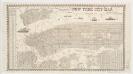
New York city map
Miller, James J. Miller
Outline & Index Map of New York City. Index I.
from Atlas of the city of New York : embracing all territory within its corporate limits from official records, private plans & actual surveys / by and under the supervision of E. Robinson & R.H. Pidgeon, civil engineers.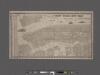
New York City map. Including an index to the streets of New York and Brooklyn.
From Manhattan
Boroughs of Manhattan and Bronx, showing the electric service of the New York Edison Co.
From Manhattan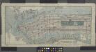
Title on face of map: Albemarle Hotel map of Manhattan, City of New York
from Manhattan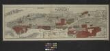
Map of the borough of Manhattan and part of the Bronx showing location and extent of racial colonies.
From Manhattan
New handy map of New York City.
From Manhattan
Johnson's Map of NYC.
From Manhattan
Watson's New Map Of New-York And Adjacent Cities.
1 : 18600 Watson, Gaylord
Aerial survey, Manhattan Island,New York City.
From Manhattan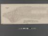
Fire Chart of the Borough of Manhattan, N.Y.
From Manhattan
Goulding's Directory Map of New York City, including the two recently annexed wards, engraved from the latest and most accurate surveys.
From Manhattan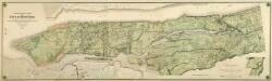
Composite: Topographical Atlas Of The City Of New York
1 : 12000 Viele, Egbert L.
New York (City) and Brooklyn.
1 : 32000 Johnson, A.J.
New York (City) and Brooklyn.
1 : 32000 Johnson, A.J.
1. New York City.
1 : 80000 Servoss, R. D.