Maps of Zlatibor District

Ivanjica.; Spezialkarte der osterreichisch-ungarischen Monarchie.
from Spezialkarte der osterreichisch-ungarischen Monarchie. Austro-Hungarian Monarchy. Militärgeographisches Institut.,
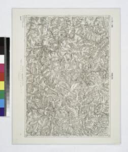
Užice
1 : 200000 Užice (Srbsko) Kartografska radionica
Uzice.
from Spezialkarte der osterreichisch-ungarischen Monarchie.
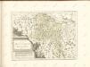
Nordwest-Serbien
1 : 650000 Serbien
Nahia Pečská Diakovská i Prizrenská
Albánie Müller, Jos. D.
Pachalik de Belgrade 1800
Serbien Osmanisches Reich Belgrad Verwaltungsbezirk
Zemljepis od Serbie
1 : 830000 Srbsko Nipočić, Vasilij u c. k. Politechničeskoj inščotugu
Karta Serbije
1 : 575000 Srbsko Bilic, F. Kocebu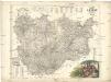
Karta knjažestva Serbie
1 : 375000 Srbsko Bugarski, Iovan Rau, J.
XIX, uit: General-Karte des oesterreichischen Kaiserstaates mit einem grossen Theile der angrenzenden Länder / durch Josef Scheda ... bearb. und hrsg
1 : 576000 Annotatie geografische gegevens: Maatstokken: oesterreichische Meilen, geografische oder deutsche Meilen, preussische Meilen, türkische Berri, französische Lieues, russische Werste; Maatstok per blad: wiener Klafter, öster. Meilen; Blad XIX: statistische en taalkundige informatie; Blad XIX: legenda [Wien : K.K. Militärisch-Geografisches Institut]
Knjažestvo Srbije
1 : 493000 Srbsko Milenkovie, Iovan
Veles, Priština, Scutari
1 : 750000 Priština (Kosovo) Konrad, A. Erben, Fr. K. u. k. Militärgeographisches Institut
Rascien
1 : 800000 Sandschak Novi Pazar , Kosovo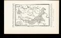
La Serbie de Karageorges et de 1833-78
Serbien Geschichte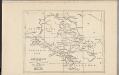
Montenegro
Montenegro
La Serbie de 1878
Serbien Geschichte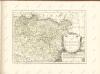

Servia. Coal Resources of the World.
1 : 1500000 Milojkovitch, J.A.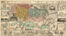
Regnum Bosniae, una cum finitimis Croatiae, Dalmatiae, Slavoniae, Hung. et Serviae partibus praecipuorum in his regionibus munimentorum ichnographia Curantibus
1 : 840000 Mollova mapová sbírka Ötinger, Johann Homann, Johann Baptista - dědici
Carte generale
Albanien
Eisenbahnbau 1884-1915
Serbien Eisenbahnnetz
Strassen- und Eisenbahnkarte des oesterreichischen Kaiserthumes
1 : 864000 Blatt 15 Schaller, G. K.K. Militärisch-Geografisches Institut, Karten-Evidenthaltungs-Abteilung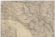
[Montenegro und angrenzende Länder]
Bělehrad (Srbsko : oblast)
Herzegovina, Montenégro, Albanie Superieure
Nouvel atlas physique politique et historique de l'Empire ottoman et des états limitrophes en Europe, en Asie et en Afrique, en quarante feuilles Hellert, J.J. Bellizard, Dufour et Cie
Administrative Gliederung Serbiens in Kreise und Bezirke 1890 (1891)
Serbien Verwaltungsgliederung
Bevölkerungsdichte 1900 (administrative Gliederung von 1902)
Serbien Bevölkerungsdichte
Administrative Gliederung Serbiens in Kreise und Bezirke 1902
Serbien Verwaltungsgliederung
Serbien
1 : 800000 Srbsko Kiepert, Heinrich Bugarski Geographisches Institut