Maps of Poděbrady

Lázně - Poděbrady

Poděbrady

Poděbrady

Plán královského komorního a lázeňského města Poděbrad
Poděbrady (Česko : oblast) Vejvoda, Josef Vzděl. Sbor. Sv.
Poděbrady

Pollabetz - c5968-1-001 - Kaiserpflichtexemplar der Landkarten des stabilen Katasters
1 : 2880
Pollabetz - c5968-1-002 - Kaiserpflichtexemplar der Landkarten des stabilen Katasters
1 : 2880
Podiebrad - c5882-1-002 - Kaiserpflichtexemplar der Landkarten des stabilen Katasters
1 : 2880
Podiebrad - c5882-1-007 - Kaiserpflichtexemplar der Landkarten des stabilen Katasters
1 : 2880
Podiebrad - c5882-1-004 - Kaiserpflichtexemplar der Landkarten des stabilen Katasters
1 : 2880
Podiebrad - c5882-1-001 - Kaiserpflichtexemplar der Landkarten des stabilen Katasters
1 : 2880
Podiebrad - c5882-1-003 - Kaiserpflichtexemplar der Landkarten des stabilen Katasters
1 : 2880
Podiebrad - c5882-1-005 - Kaiserpflichtexemplar der Landkarten des stabilen Katasters
1 : 2880
Podiebrad - c5882-1-006 - Kaiserpflichtexemplar der Landkarten des stabilen Katasters
1 : 2880
Kluk - c3187-1-004 - Kaiserpflichtexemplar der Landkarten des stabilen Katasters
1 : 2880
Kluk - c3187-1-005 - Kaiserpflichtexemplar der Landkarten des stabilen Katasters
1 : 2880
Kluk - c3187-1-003 - Kaiserpflichtexemplar der Landkarten des stabilen Katasters
1 : 2880
Kluk - c3187-1-001 - Kaiserpflichtexemplar der Landkarten des stabilen Katasters
1 : 2880
Kluk - c3187-1-002 - Kaiserpflichtexemplar der Landkarten des stabilen Katasters
1 : 2880
Bestandeskarte für die Excursion des böhmischen Forstvereines im August 1896 auf der Domaine Poděbrad nach Befund des Wirtschaftjahres 1896
1 : 17280 Poděbrady-oblast (Česko) Voborník, Fr.
Bestandeskarte sammt nächster Umgebung für die Excursion des böhmischen Forstvereines im Juli 1907 auf der Domaine Poděbrad nach Befund des Wirtschaftjahres 1907
Poděbrady-oblast (Česko) Voborník, F. Renard Kartografie Ant. Vítek
III. vojenské mapování 3954/2
1 : 25000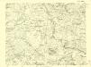
III. vojenské mapování 3954/2
1 : 25000
Gradkartenblatt
1 : 25000 Poděbrady-oblast (Česko) Ansion, Victor
Eisenbahn Karte Wien-Dresden, Ollmütz-Trübau
1 : 72000 Blatt 12 Minarzik, Anselm J. Rauh

Podrobné mapy zemí Koruny české v měřítku 1:75.000 a mapa vzdáleností všech míst při silnici ležících
1 : 75000 Kouřim (Česko : oblast) Bělohlav, Josef F. Topič
III. vojenské mapování 3954
1 : 75000
Neu-Kolin
1 : 75000 Kolín (Česko : oblast) Ansion K. u. k. Militärgeographisches Institut


