Maps of Hungary

Nástěnná mapa Střední Evropy

Provincia Austriaca Societatis Iesu
1 : 1700000 Mollova mapová sbírka Seutter, Matthäus Mayr, Johann Baptist Seutter, Matthäus
Routen und Manipulations-Karte der oesterr[eichischen] ungar[ischen] Eisenbahnen
Rakousko-Uhersko Stulík, František Nechvíle, Josef J. Farský
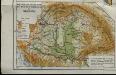
Karte von Ungarn
Maďarsko Torsch, Franz
Die Bezirke der Tendenz "A" vor 1875
Ungarn Wahlbezirk, Wahlverhalten
Karte von Königreich Ungarn und den zugehörigen Nebenländern
1 : 1887000 Maďarsko Schmitfeldt, Georg Lipský, Ján Florian Mollo
Hungary.
1 : 3800000 Darton, William
Regni Norici et Pannoniae Superioris Veteres Populi et Inquilini
1 : 2850000 Mollova mapová sbírka Clüver, Philipp Fuhrmann, Mathias

L'Empire, d'Allemagne
1 : 1200000 Mollova mapová sbírka Sanson, Nicolas Quasy, Robert
L'Alemagne 4.
1 : 1800000 Rizzi Zannoni, Giovanni Antonio Bartolomeo, 1736-1814
Danubii Fluminis [ab urbe Lentia utq; et ultra Bydenam urbem cum influentibus fluviis delineati] Pars Media
1 : 2000000 Mollova mapová sbírka Homann, Johann Baptist Homann, Johann Baptista
Postkarte von Nieder Ungarn, Kroatien und Sklavonien
Chorvatsko Kühn, Ignaz im von Reillyschen Landkarten und Kunstwerke Verschleiss Komptoir
Die Kaiserlich Oesterreichischen Ungarischen Erbstaaten

Hungary.
1 : 3041280 Tallis, J. & F.
Hungaria Regnum
59-60. Cecoslovacchia, Ungheria.
1 : 1500000 Touring club italiano
L'Empire d'Autriche
Nouvel atlas physique politique et historique de l'Empire ottoman et des états limitrophes en Europe, en Asie et en Afrique, en quarante feuilles Hellert, J.J. Bellizard, Dufour et Cie
Karte der Königreiche Ungarn, Croatien, Slavonien und Militärgrenzen
Mountains and plains of the old kingdom of Hungary [Nebenkarte]
Ungarn Topografie Teleki, Pál Teleki, Pál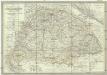
Die kaiserlich oesterreichischen ungarischen Erbstaaten, das ist Ungarn, Siebenbürgen, Dalmatien und die Militair-Graenze
1 : 1522000 Dalmácie (Chorvatsko) Weiland, Karl Ferdinand im Verlage des Geographischen Instituts
Kaiserlich Oesterreichischen Ungarischen Erbstaaten
1 : 1500000 Dalmácie (Chorvatsko) Weiland, Karl Ferdinand Geographischen Instituts
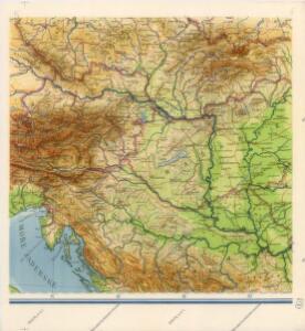
Magyarország hegy- és vizrajzi térképe
1 : 3500000 Karpaty (pohoří : oblast) Homolka, Josef Posner Károly Lajos és Fia
Skelett für die Special-Karte des Königreichs Ungarn mit dem Grofsfürstenthume Siebenbürgen, der Königreiche Croatien u[nd] Slavonien, dann der k.k. Militärgrenze
1 : 75000 Chorvatsko K. u. k. Militärgeographisches Institut
Provincia Austriaca Societatis Iesu
Evropa jihovýchodní Seutter, Matthäus Mayr, Johann Baptist Matthäus Seutter
Provincia Austriaca Societatis Iesu
Evropa jihovýchodní Seutter, Matthäus Kappus, Marcus Antonius a Matthaeo Seutter
Karte von Deutschland in IV Blättern
1 : 825000 Südost-Blatt Sotzmann, Daniel Friedrich im Verlage der A. G. Schneider und Weigels
A Magyar szt. korona országai
1 : 2500000 Evropa východní Hölzel Ede
Hongrie.
1 : 4500000 Delamarche, Charles Francois; Lattre, Jean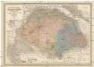
Die kaiserlich Oesterreichischen Ungarischen Erbstaaten
1 : 522000 Budapešť-oblast (Maďarsko) Weiland, Karl Ferdinand im Verlage des Geographischen Instituts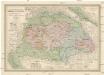
Die kaiserlich Oesterreichischen Ungarischen Erbstaaten
Maďarsko Weiland, Karl Ferdinand Prixner, Godofr. im Verlage des Geographischen Instituts
Die kaiserlich Oesterreichischen Ungarischen Erbstaaten
Maďarsko Weiland, Karl Ferdinand Prixner, Godofr. im Verlage des Geographischen Instituts