Maps of Czech Republic

Historická mapa Čech
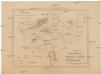
Übersichtskarte der Kohlenformationen und Eisenbahnen in Böhmen
Duchcov-oblast (Česko)
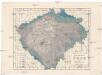
Geognostisch-montanistische Geschäfts- und Communicationenkarte des Königreiches Böhmen
1 : 100000 Česko Schmidt, Johann Ferdinand Schmidt, Eduard Rziwnač
Země česká

Historická mapa Čech
1 : 525000 Česko Palacký, František Kalausek, Josef nákladem Kr. č. učené společnosti
Historická mapa Čech
1 : 525000 Česko Palacký, František Kalousek, Josef nákladem Kr. č. učené společnosti
Das Königreich Böhmen
1 : 600000 Čechy (Česko) Gräf, C. Greyer, V. Geographisches Institut
Das Königreich Böhmen
1 : 600000 Čechy (Česko) Gräf, C. Greyer, V. Geographisches Institut
Bez titulu: Statistické mapky Čech

Čechy
1 : 1000000 Česko Ústřední nakladatelství a knihkupectví učitelstva československého
General-Karte von Böhmen
1 : 500000 Česko R. Lechner (Wilh. Müller)
General-Karte von Böhmen
1 : 500000 Česko R. Lechner (Wilh. Müller)
Karte der Bevölkerungsdichte (relative Bevölkerung) des Königreiches Böhmen
1 : 600000 Česko Hickmann, Anton L. A.L. Hickmann
Bez titulu: Statistické mapky Čech

Isochronická mapa Čech
1 : 750000 Česko Nový, Václav Václav Nový
Isochronická mapa Čech
1 : 750000 Česko Nový, Václav Klub českých turistů
Mapa výšek s vrstvami Království českého
Čechy (Česko) Kořistka, Karel František Edvard Kapras, Jan nákladem J. Otty
Mapa výšek s vrstvami Království českého
Čechy (Česko) Kořistka, Karel František Edvard nákladem J. Otty
Mapa výšek s vrstvami Království českého
Čechy (Česko) Kořistka, Karel František Edvard
Mapa výšek s vrstvami Království českého
Čechy (Česko) Kořistka, Karel František Edvard nákladem J. Otty
Karten zur Statistik des Königreiches Böhmen

Bez titulu: Statistické mapky Čech
Dešťopisná mapa Čech
Čechy (Česko) Studnička, František Josef Langweil, Antonín
Dešťopisná mapa Čech
Čechy (Česko) Studnička, František Josef
Vodní mapa Čech se sití [sic] železniční
1 : 374000 Česko Mayr, Jos. Spolek českých lesníků
Statistisch topographische Finanz-Karte des Königreiches Boehmen
1 : 421500 Čechy (Česko) Herz, Johann Kübeck zu Kübau, Carl Friedrich bei Gottlieb Haase Sohne
Zeměpisná a cestovní mapa Čech znázorňující rozšíření Chvojkových napájedel
1 : 440000 F. Chvojka
Mapa poštovních spojů v Čechách
1 : 400000 Pardubice (Česko : oblast) Ministerstvo pošt a telegrafů
Mapa poštovních spojů v Čechách
1 : 400000 Česko Pachman, Josef Ministerstvo pošt a telegrafů
Přehledná mapa železniční Království českého
1 : 600000 Česko Zemský výbor


