Maps of okres Mladá Boleslav
Special - Karte des Koenigreiches Boehmen

II. vojenské mapování 8
1 : 144000
II. vojenské mapování 8
1 : 144000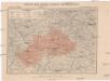
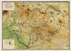
Generální mapa okresního hejtmanství Mnich. Hradištského
1 : 220000 Mnichovo Hradiště-oblast (Česko) Wagner, Jan Eduard F. Kytka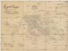
General-Karte der Fideikommiss Herrschaften Münchengraetz, Weiswasser Hirschberg u. Neuperstein
1 : 71200 Bělá pod Bezdězem-oblast (Česko) Placht, W.
Zur Erinnerung an den 15. 16. u. 17. Mai 1860
Kokořín-oblast (Česko) Wagner, Jan Eduard

Wandkarte des politischen Bezirkes Dauba

Straßen-Karte des auton. Bezirkes Dauba
1 : 50000 Dubá (Česko : oblast)
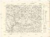
Mělník
1 : 75000 Mělník-oblast (Česko) Vojenský zeměpisný ústav
Mělník
1 : 75000 Mělník (Česko : oblast) Vojenský zeměpisný ústav
Mělník
1 : 75000 Mělník (Česko : oblast) Vojenský zeměpisný ústav
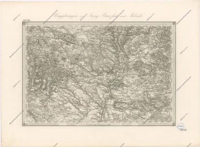
Jungbunzlau und Liban
1 : 75000 Libáň (Jičín, Česko : oblast) Heimbach K. u. k. Militärgeographisches Institut
Jungbunzlau und Liban
1 : 75000 Libáň (Jičín, Česko : oblast) K. u. k. Militärgeographisches Institut
Soubor přehledných map pro plánování a statistiku: 3853 – Mělník

Mapy plánování ČSR

III. vojenské mapování 3853
1 : 75000
Soubor přehledných map pro plánování a statistiku: 3853 – Mělník

[Kartenblatt]
1 : 25000 Bakov nad Jizerou (Česko : oblast) Reichsamt für Landesaufnahme

III. vojenské mapování 3853/2
1 : 25000
Gradkartenblatt
1 : 25000 Mladá Boleslav-oblast (Česko) Bellschan, Anton

[Kartenblatt]
1 : 25000 Mnichovo Hradiště (Česko : oblast) Reichsamt für Landesaufnahme
III. vojenské mapování 3854/1
1 : 25000
III. vojenské mapování 3753/4
1 : 25000