Maps of okres Mladá Boleslav

II. vojenské mapování 8
1 : 144000
II. vojenské mapování 8
1 : 144000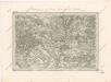
Special - Karte des Koenigreiches Boehmen

Generální mapa okresního hejtmanství Mnich. Hradištského
1 : 220000 Mnichovo Hradiště-oblast (Česko) Wagner, Jan Eduard F. Kytka
General-Karte der Fideikommiss Herrschaften Münchengraetz, Weiswasser Hirschberg u. Neuperstein
1 : 71200 Bělá pod Bezdězem-oblast (Česko) Placht, W.
Umgebung von Jičin
1 : 75000 Jičín (Česko : oblast) K. u. k. militär-geographisches Institut
Umgebung von Jičín I.

Podrobná mapa Království českého, Markrabství moravského a Vévodství slezského
1 : 100000 Jičín (Česko : oblast) Srp, Jan Jos. R. Vilímek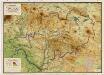
Wandkarte des politischen Bezirkes Dauba

Jungbunzlau und Liban
1 : 75000 Libáň (Jičín, Česko : oblast) Heimbach K. u. k. Militärgeographisches Institut
Jungbunzlau und Liban
1 : 75000 Libáň (Jičín, Česko : oblast) K. u. k. Militärgeographisches Institut
Mělník
1 : 75000 Mělník-oblast (Česko) Vojenský zeměpisný ústav
Mělník
1 : 75000 Mělník (Česko : oblast) Vojenský zeměpisný ústav
Mělník
1 : 75000 Mělník (Česko : oblast) Vojenský zeměpisný ústav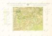
Geologická mapa Československé republiky: Mladá Boleslav 3854

III. vojenské mapování 3854
1 : 75000


Zur Erinnerung an den 15. 16. u. 17. Mai 1860
Kokořín-oblast (Česko) Wagner, Jan Eduard

[Kartenblatt]
1 : 25000 Bakov nad Jizerou (Česko : oblast) Reichsamt für Landesaufnahme

III. vojenské mapování 3853/2
1 : 25000
Gradkartenblatt
1 : 25000 Mladá Boleslav-oblast (Česko) Bellschan, Anton
[Kartenblatt]
1 : 25000 Mnichovo Hradiště (Česko : oblast) Reichsamt für Landesaufnahme
III. vojenské mapování 3854/1
1 : 25000
III. vojenské mapování 3753/4
1 : 25000

Gradkartenblatt
1 : 25000 Mnichovo Hradiště-oblast (Česko) Guggenberg zu Riedhofen, Athanasius von


