Maps of Northumberland

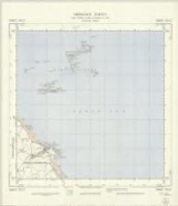
NU23 - OS 1:25,000 Provisional Series Map
1 : 25000 Topographic maps Ordnance Survey Ordnance Survey
Northumberland XVII - OS Six-Inch Map
1 : 10560 Topographic maps Ordnance Survey Ordnance Survey
Farne. [Karte], in: Novus atlas absolutissimus, Bd. 8, S. 115.
1 Karte aus Atlas Janssonius Offizin
Northumberland XVII.NE - OS Six-Inch Map
1 : 10560 Topographic maps Ordnance Survey Ordnance Survey
Northumberland nXIII.NE - OS Six-Inch Map
1 : 10560 Topographic maps Ordnance Survey Ordnance Survey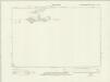
Northumberland nXIII.SE - OS Six-Inch Map
1 : 10560 Topographic maps Ordnance Survey Ordnance Survey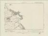
Northumberland nXVIII.NE - OS Six-Inch Map
1 : 10560 Topographic maps Ordnance Survey Ordnance Survey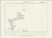
Northumberland XIIA.SE - OS Six-Inch Map
1 : 10560 Topographic maps Ordnance Survey Ordnance Survey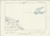
Northumberland XVII.NW - OS Six-Inch Map
1 : 10560 Topographic maps Ordnance Survey Ordnance Survey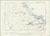
Northumberland XVII.SW & SE - OS Six-Inch Map
1 : 10560 Topographic maps Ordnance Survey Ordnance Survey
Northumberland (Old Series) XVII.10 & 15 (includes: North Sunderland) - 25 Inch Map
1 : 2500 Topographic maps Ordnance Survey Ordnance Survey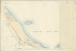
Northumberland (Old Series) XVII.15 (includes: North Sunderland) - 25 Inch Map
1 : 2500 Topographic maps Ordnance Survey Ordnance Survey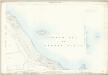
Northumberland (Old Series) XVII.10 & 15 (includes: Monks House; North Sunderland; Shoreston) - 25 Inch Map
1 : 2500 Topographic maps Ordnance Survey Ordnance Survey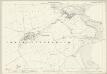
Northumberland (Old Series) XVII.14 (includes: Beadnell; North Sunderland; Shoreston) - 25 Inch Map
1 : 2500 Topographic maps Ordnance Survey Ordnance Survey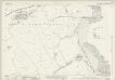
Northumberland (New Series) XVIII.7 (inset XVIII.8) (includes: Beadnell) - 25 Inch Map
1 : 2500 Topographic maps Ordnance Survey Ordnance Survey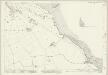
Northumberland (New Series) XIII.14 (inset XIII.15) (includes: Shoreston) - 25 Inch Map
1 : 2500 Topographic maps Ordnance Survey Ordnance Survey
Northumberland (New Series) XVIII.3 (includes: North Sunderland; Shoreston) - 25 Inch Map
1 : 2500 Topographic maps Ordnance Survey Ordnance Survey
Northumberland (New Series) XVIII.7 (inset XVIII.8) (includes: Beadnell; North Sunderland) - 25 Inch Map
1 : 2500 Topographic maps Ordnance Survey Ordnance Survey
Northumberland XIIa - OS Six-Inch Map
1 : 10560 Topographic maps Ordnance Survey Ordnance Survey
Northumberland XIIA.SW - OS Six-Inch Map
1 : 10560 Topographic maps Ordnance Survey Ordnance Survey
Northumberland (Old Series) XXII.3 (includes: Beadnell) - 25 Inch Map
1 : 2500 Topographic maps Ordnance Survey Ordnance Survey
Northumberland (New Series) XVIII.6 (includes: Burton; Elford; North Sunderland; Shoreston) - 25 Inch Map
1 : 2500 Topographic maps Ordnance Survey Ordnance Survey
Northumberland (New Series) XVIII.2 (includes: Bamburgh; Burton; North Sunderland; Shoreston) - 25 Inch Map
1 : 2500 Topographic maps Ordnance Survey Ordnance Survey
Northumberland (New Series) XIII.14 (inset XIII.15) (includes: Bamburgh; Burton; Monks House; Shoreston) - 25 Inch Map
1 : 2500 Topographic maps Ordnance Survey Ordnance Survey
Northumberland (New Series) XIII.10 (includes: Bamburgh Castle; Bamburgh) - 25 Inch Map
1 : 2500 Topographic maps Ordnance Survey Ordnance Survey
Holy Island (Hills) - OS One-Inch Revised New Series
1 : 63360 Topographic maps Ordnance Survey Ordnance Survey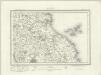
Holy Island (Outline) - OS One-Inch Revised New Series
1 : 63360 Topographic maps Ordnance Survey Ordnance Survey
Insvla sacra; vulgo Holy Iland; et Farne
1 Karte : Kupferdruck ; 37 x 49 cm Blaeu Joan Blaeu
Insula Sacra; Vulgo Holy Iland; et Farne. [Karte], in: Theatrum orbis terrarum, sive, Atlas novus, Bd. 4, S. 530.
1 Karte aus Atlas Blaeu, Joan Blaeu, Willem Janszoon