Maps of Northumberland

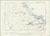
Holy Island (Hills) - OS One-Inch Revised New Series
1 : 63360 Topographic maps Ordnance Survey Ordnance Survey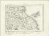
Holy Island (Outline) - OS One-Inch Revised New Series
1 : 63360 Topographic maps Ordnance Survey Ordnance Survey
Insvla sacra; vulgo Holy Iland; et Farne
1 Karte : Kupferdruck ; 37 x 49 cm Blaeu Joan Blaeu
Insula Sacra; Vulgo Holy Iland; et Farne. [Karte], in: Theatrum orbis terrarum, sive, Atlas novus, Bd. 4, S. 530.
1 Karte aus Atlas Blaeu, Joan Blaeu, Willem Janszoon
Insula Sacra; Vulgo Holy Island; et Farne. [Karte], in: Le théâtre du monde, ou, Nouvel atlas contenant les chartes et descriptions de tous les païs de la terre, Bd. 4, S. 446.
1 Karte aus Atlas Blaeu, Willem Janszoon und Blaeu, Joan Blaeu, Willem Janszoon
Insula Sacra; Vulgo Holy Iland; et Farne. [Karte], in: Theatrum orbis terrarum, sive, Atlas novus, Bd. 4, S. 530.
1 Karte aus Atlas Blaeu, Joan Blaeu, Willem Janszoon
INSVLA SACRA; | Vulgo | HOLY ILAND [!]; | et | FARNE.
[Amsterdam : Joan Blaeu]
Holy Iland ; Garnsey ; Farne ; Iarsey
[Amstelodami] : [apud Joannem Janssonium]
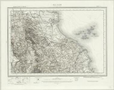
NU13 - OS 1:25,000 Provisional Series Map
1 : 25000 Topographic maps Ordnance Survey Ordnance Survey
NU03 - OS 1:25,000 Provisional Series Map
1 : 25000 Topographic maps Ordnance Survey Ordnance Survey
Northumberland XIIa - OS Six-Inch Map
1 : 10560 Topographic maps Ordnance Survey Ordnance Survey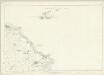
Northumberland XVII - OS Six-Inch Map
1 : 10560 Topographic maps Ordnance Survey Ordnance Survey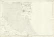
Northumberland XII - OS Six-Inch Map
1 : 10560 Topographic maps Ordnance Survey Ordnance Survey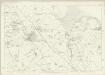
Northumberland XVI - OS Six-Inch Map
1 : 10560 Topographic maps Ordnance Survey Ordnance Survey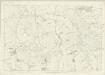
Northumberland XV - OS Six-Inch Map
1 : 10560 Topographic maps Ordnance Survey Ordnance Survey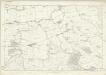
Northumberland XI - OS Six-Inch Map
1 : 10560 Topographic maps Ordnance Survey Ordnance Survey
Farne. [Karte], in: Novus atlas absolutissimus, Bd. 8, S. 115.
1 Karte aus Atlas Janssonius Offizin
NU23 - OS 1:25,000 Provisional Series Map
1 : 25000 Topographic maps Ordnance Survey Ordnance Survey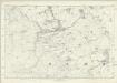
Northumberland XXI - OS Six-Inch Map
1 : 10560 Topographic maps Ordnance Survey Ordnance Survey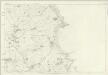
Northumberland XXII - OS Six-Inch Map
1 : 10560 Topographic maps Ordnance Survey Ordnance Survey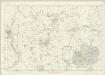
Northumberland XX - OS Six-Inch Map
1 : 10560 Topographic maps Ordnance Survey Ordnance Survey
Holy Iland. [Karte], in: Novus atlas absolutissimus, Bd. 8, S. 115.
1 Karte aus Atlas Janssonius Offizin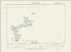
Northumberland XIIA.SE - OS Six-Inch Map
1 : 10560 Topographic maps Ordnance Survey Ordnance Survey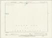
Northumberland XVII.NE - OS Six-Inch Map
1 : 10560 Topographic maps Ordnance Survey Ordnance Survey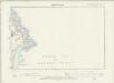
Northumberland XXII.NE - OS Six-Inch Map
1 : 10560 Topographic maps Ordnance Survey Ordnance Survey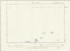
Northumberland XIIA.SW - OS Six-Inch Map
1 : 10560 Topographic maps Ordnance Survey Ordnance Survey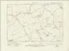
Northumberland nVII.SE - OS Six-Inch Map
1 : 10560 Topographic maps Ordnance Survey Ordnance Survey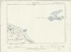
Northumberland XVII.NW - OS Six-Inch Map
1 : 10560 Topographic maps Ordnance Survey Ordnance Survey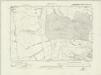
Northumberland nXI.NE - OS Six-Inch Map
1 : 10560 Topographic maps Ordnance Survey Ordnance Survey