Maps of Falkirk
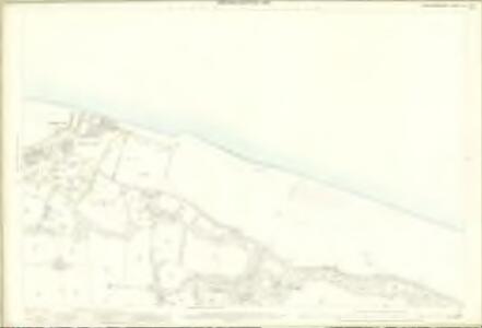
Linlithgowshire, Sheet 001.08 - 25 Inch Map
1 : 2500 Topographic maps Ordnance Survey Ordnance Survey
Linlithgow, Sheet I.8 (Carriden) - OS 25 Inch map
1 : 2500 Topographic maps Ordnance Survey Ordnance Survey
Linlithgowshire Sheet I.NE - OS 6 Inch map
1 : 10560 Topographic maps Ordnance Survey Ordnance Survey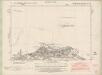
Stirlingshire Sheet n XXV.SE - OS 6 Inch map
1 : 10560 Topographic maps Ordnance Survey Ordnance Survey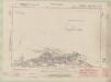
Linlithgowshire Sheet n I.SE - OS 6 Inch map
1 : 10560 Topographic maps Ordnance Survey Ordnance Survey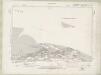
Linlithgowshire Sheet n I.SE - OS 6 Inch map
1 : 10560 Topographic maps Ordnance Survey Ordnance Survey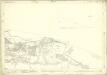
Linlithgowshire, Sheet n001.16 & n002.13 - 25 Inch Map
1 : 2500 Topographic maps Ordnance Survey Ordnance Survey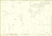
Linlithgowshire, Sheet n003.04 - 25 Inch Map
1 : 2500 Topographic maps Ordnance Survey Ordnance Survey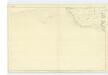
Fife, Sheet 38 - OS 6 Inch map
1 : 10560 Topographic maps Ordnance Survey Ordnance Survey
NT08 - OS 1:25,000 Provisional Series Map
1 : 25000 Topographic maps Ordnance Survey Ordnance Survey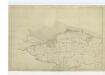
Linlithgowshire, Sheet 1 - OS 6 Inch map
1 : 10560 Topographic maps Ordnance Survey Ordnance Survey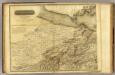
Edinburgh Shire 1 N.
1 : 43000 Knox, James
A new description of the shyres Lothian and Linlitquo
1 : 171000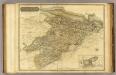
Linlithgowshire.
1 : 55000 Thomson, John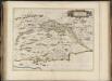
Fifae pars occidentalis, [vulgo], The West Part of Fife.
Blaeu, Joan, 1596-1673
Edinburgh - OS One-Inch map
1 : 63360 Topographic maps Ordnance Survey Ordnance Survey
Edinburgh - OS One-Inch map
1 : 63360 Topographic maps Ordnance Survey Ordnance Survey
[Edinburgh] - OS One-Inch map
1 : 63360 Topographic maps Ordnance Survey Ordnance Survey
Stirling & Dunfermline (67) - OS One-Inch map
1 : 63360 Topographic maps Ordnance Survey Ordnance Survey
Stirling & Dunfermline (67) - OS One-Inch map
1 : 63360 Topographic maps Ordnance Survey Ordnance Survey
Volume 1: Sheet 32 - Edinburgh
1 : 63360 Farquharson, J.
FIFÆ PARS | OCCIDENTALIS, | THE WEST PART OF FIFE.
[Amsterdam : Joan Blaeu]
Falkirk & Motherwell (73) - OS One-Inch map
1 : 63360 Topographic maps Ordnance Survey Ordnance Survey
Falkirk & Motherwell (73) - OS One-Inch map
1 : 63360 Topographic maps Ordnance Survey Ordnance Survey
Composite: Edinburgh Shire N.
1 : 43000 Knox, James
[A map of Strath Devon and the district between the Ochils and the Forth]
Adair, John, ca. 1650-1722
STERLINENSIS | PRÆFECTVRA. | STERLIN-SHYR.
Auct. Timoth Pont. [Amsterdam : Joan Blaeu]
Falkirk and Lanark - OS One-Inch Map
1 : 63360 Topographic maps Ordnance Survey Ordnance Survey
Perth and Alloa - OS One-Inch Map
1 : 63360 Topographic maps Ordnance Survey Ordnance Survey